USSR Ministry of Defense
Newport News and Hampton, VA 1 (USA) - Soviet Military City Plans
Newport News and Hampton, VA 1 (USA) - Soviet Military City Plans
Regular price
$49.95 USD
Regular price
Sale price
$49.95 USD
Unit price
per
Shipping calculated at checkout.
Couldn't load pickup availability
- SKU: SUAA-NEWPORTNEWS1-P
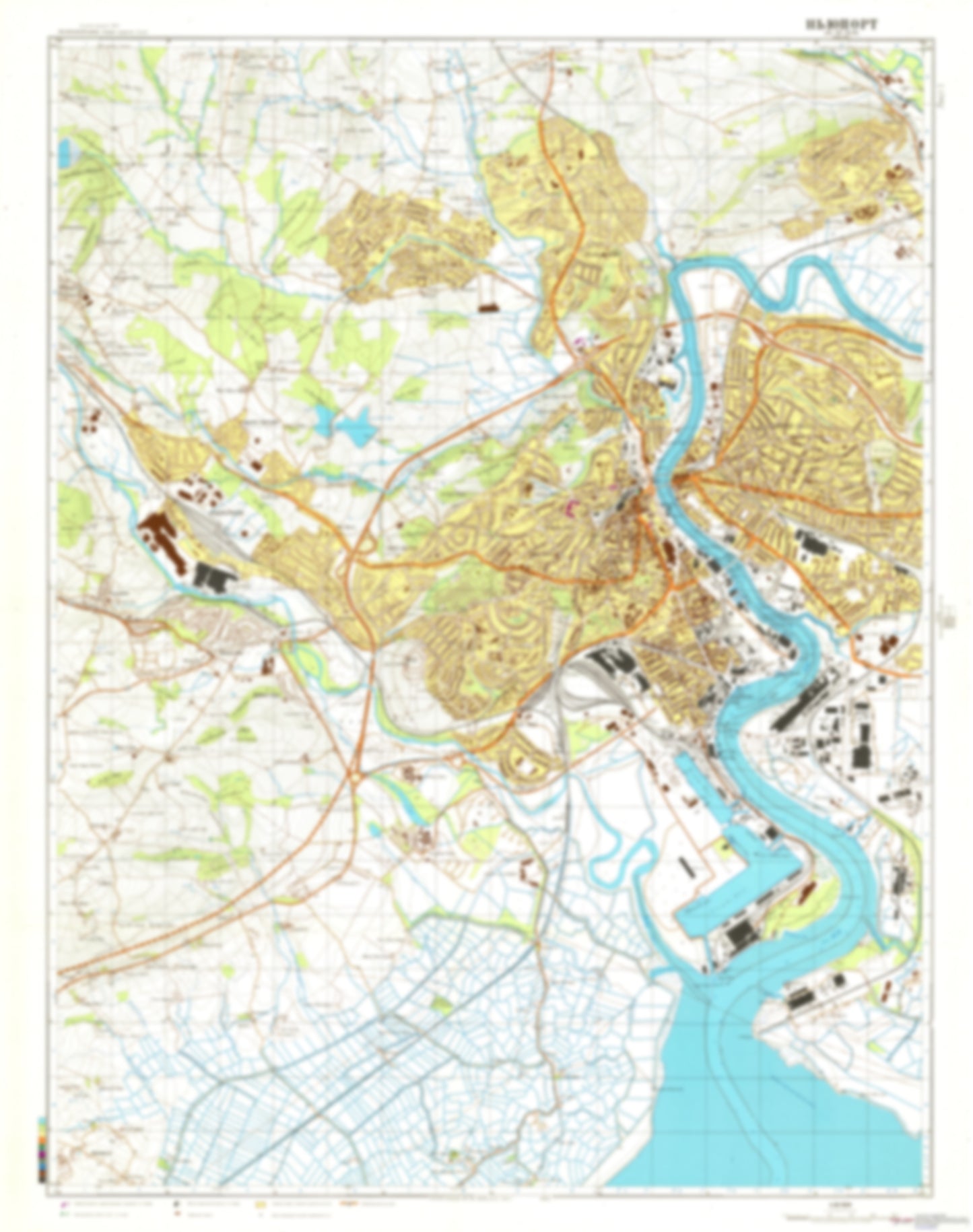
- During the Cold War and before easy access to high-resolution satellite imagery, The Soviet Military was secretly mapping the entire world. These aesthetically striking maps are beautiful down to the last detail and fantastic wall art and until now, have rarely been viewed or available to outsiders. This series has been covered by Wired Magazine and Greg Miller in his book, "All Over the Map: A Cartographic Odyssey". This map is part of the Soviet City Plans Series presented by East View, which has the largest collection of Soviet Military City Plans in the world. The Soviet Military City Plan(s) of Newport News and Hampton, VA 1 (USA) is one in a series of highly detailed topographic city maps developed by the USSR Ministry of Defense during the Cold War era. These collectable, high resolution print-on-demand editions are delivered on premium, acid-free, matte paper. This item is sheet number 1 in a set of 2 sheet(s) for Newport News and Hampton, VA Populated Places: City of Newport News, District 2, District 4, District 5, Newport District, Smithfield District, Town of Smithfield Military and Defense: Fort Eustis Landmarks and Natural Features: Blunt Point, Calthrop Neck, Candy Island, Chalmers Point, Curtis Point, Curtis Point, Days Point, East Island, Fish Neck, Fishing Point, Gatling Point, Goose Island, Hickory Point, Jail Point, Marshy Point, Mulberry Island, Mulberry Point, Newport News Point, Ragged Island, Rainbow Farm Point, Red Point, Ship Point, Swash Hole Island, Thorofare Island, Thorofare Point Water Bodies: Batten Bay, Big Bethel Reservoir, Browns Lake, City Reservoir, Eustis Lake, Harwoods Mill Reservoir, Hodges Cove, Indigo Lake, Lake Corbin, Lake Maury, Lake Queen Anne, Lake Tormentor, Milstead Creek, Morleys Gut, Rock Landing Shoal Channel, Swash Hole, Thorofare, Willett Cove
- Subtype: City Plan
- Language: Russian
- Publication Date: 1975-06-01
- Scale: 1:25,000
- Countries Covered: United States
- MPN: NEWPORTNEWS1
- Folded Size: N/A
- Unfolded Size: 36.1" (W) x 49.1" (H)
- Weight: 4.8 oz