USSR Ministry of Defense
New York, NY 7 (USA) - Soviet Military City Plans
New York, NY 7 (USA) - Soviet Military City Plans
Regular price
$49.95 USD
Regular price
Sale price
$49.95 USD
Unit price
per
Shipping calculated at checkout.
Couldn't load pickup availability
- SKU: SUAA-NEWYORK7-P
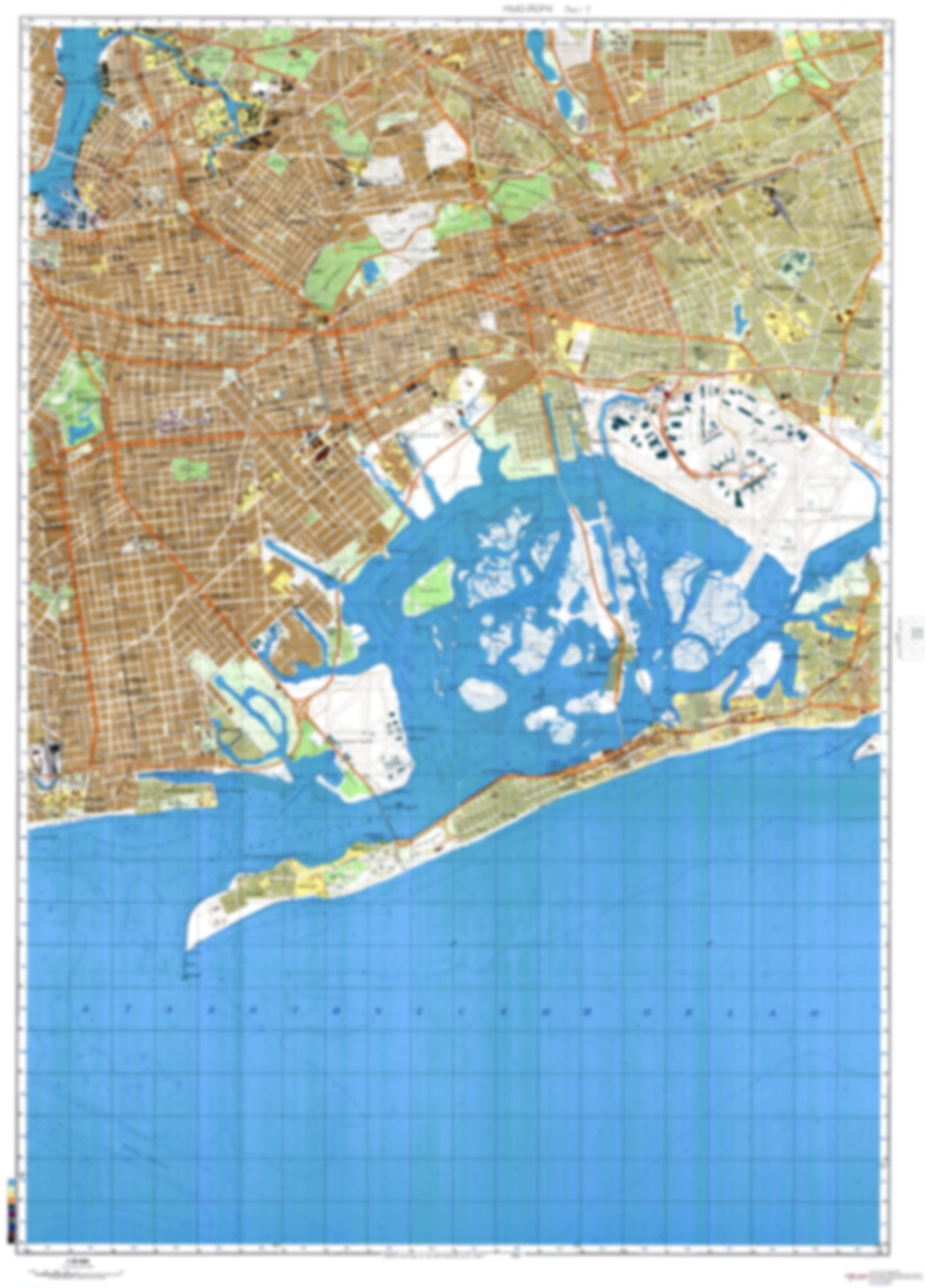
- During the Cold War and before easy access to high-resolution satellite imagery, The Soviet Military was secretly mapping the entire world. These aesthetically striking maps are beautiful down to the last detail and fantastic wall art and until now, have rarely been viewed or available to outsiders. This series has been covered by Wired Magazine and Greg Miller in his book, "All Over the Map: A Cartographic Odyssey". This map is part of the Soviet City Plans Series presented by East View, which has the largest collection of Soviet Military City Plans in the world. The Soviet Military City Plan(s) of New York, NY 7 (USA) is one in a series of highly detailed topographic city maps developed by the USSR Ministry of Defense during the Cold War era. These collectable, high resolution print-on-demand editions are delivered on premium, acid-free, matte paper. This item is sheet number 7 in a set of 9 sheet(s) for New York, NY Populated Places: City of New York, Kings County, Queens County Military and Defense: Coast Guard Air Station Brooklyn Parks and Reservations: Riches Meadows, The Raunt Landmarks and Natural Features: Barren Island, Bass Channel Island (historical), Black Point, Brant Point, Breeze Hill, Breezy Point, Canarsie Beach, Canarsie Pol, Conchs Hole Point, Coney Island Beach, Corlears Hook, Duck Island, Duck Point, Fishkill Hassocks, Grass Hassock, Green Point, Laurel Hill, Lookout Hill, Maspeth Plateau, Mau Mau Island, Motts Point, Northwest Point, Norton Point, Plumb Beach, Plumb Island Water Bodies: Ambrose Channel, Beach Channel, Big Channel, Broad Channel, Coney Island Channel, Deep Creek, Duck Creek, East Mill Basin, First Church of Brooklyn, Gerritsen Inlet, Grassy Bay, Hendrix Creek, Horse Channel, Jacks Hole Creek, Joseph Sanford Jr. Channel, Little Bay, Meadow Lake, Norton Basin, Rockaway Inlet, Runway Channel, Sommerville Basin, Straight Creek, Thurston Basin, Wallabout Bay, West Broad Channel
- Type: Map
- Subtype: City Plan
- Language: Russian
- Publication Date: 1982-06-01
- Scale: 1:25,000
- Regions Covered: Mid-Atlantic/Northeastern U.S., North America
- Countries Covered: United States
- States Covered: New York
- MPN: NEWYORK7
- Folded Size: N/A
- Unfolded Size: 34.2" (W) x 47.5" (H)
- Weight: 4.8 oz