USSR Ministry of Defense
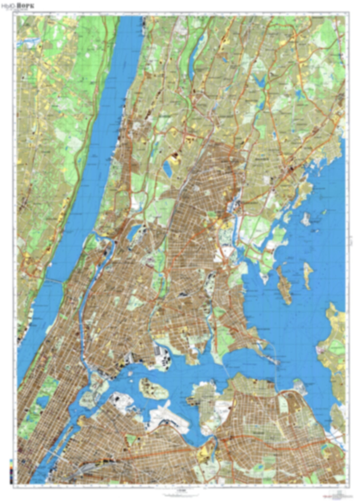
New York, NY 3 (USA) - Soviet Military City Plans
New York, NY 3 (USA) - Soviet Military City Plans
Regular price
$49.95 USD
Regular price
Sale price
$49.95 USD
Unit price
per
Shipping calculated at checkout.
Couldn't load pickup availability
- SKU: SUAA-NEWYORK3-P
- During the Cold War and before easy access to high-resolution satellite imagery, The Soviet Military was secretly mapping the entire world. These aesthetically striking maps are beautiful down to the last detail and fantastic wall art and until now, have rarely been viewed or available to outsiders. This series has been covered by Wired Magazine and Greg Miller in his book, "All Over the Map: A Cartographic Odyssey". This map is part of the Soviet City Plans Series presented by East View, which has the largest collection of Soviet Military City Plans in the world. The Soviet Military City Plan(s) of New York, NY 3 (USA) is one in a series of highly detailed topographic city maps developed by the USSR Ministry of Defense during the Cold War era. These collectable, high resolution print-on-demand editions are delivered on premium, acid-free, matte paper. This item is sheet number 3 in a set of 9 sheet(s) for New York, NY Populated Places: Bronx County, City of Englewood, City of Mount Vernon, City of New Rochelle, City of Yonkers, New York County, Town of Eastchester, Town of Mamaroneck, Town of Pelham, Town of Scarsdale Military and Defense: Yonkers Armory Parks and Reservations: Great Lawn, Sunken Meadow Landmarks and Natural Features: Barretto Point, Beaufort Point, Belden Point, Belmont Island, Berrians Neck, Blackwell Hill, Blackwells Hill, Bloomer Beach, Budds Hill, Canoe Beach, Cape Ruth, Castle Hill Point, Cedar Island, Cedar Point, Cherry Tree Point, Chimney Sweeps Islands, City Island, Clason Point, Clifford Island, College Point, Columbia Island, Cronins Hill, Cryders Point, Davenport Neck, Davids Island Water Bodies: Bronxville Lake, Cope Lake, East Channel, Eastchester Bay, Echo Bay, Grassy Sprain Reservoir, Hallets Cove, Harlem Meer, Hell Gate, Hillview Reservoir, Jacqueline Kennedy Onassis Reservoir, Little Neck Bay, Paine Lake, Pelham Lake, Pot Cove, Powell Cove, Reservoir Number Three, Sheldrake Lake, South Brother Island Channel, Spanish Cove, The Pool, Van Cortlandt Lake, Weehawken Edgewater Channel, Weir Creek, Williamsbridge Reservoir
- Type: Map
- Subtype: City Plan
- Language: Russian
- Publication Date: 1982-06-01
- Scale: 1:25,000
- Regions Covered: Mid-Atlantic/Northeastern U.S., North America
- Countries Covered: United States
- States Covered: New York
- MPN: NEWYORK3
- Folded Size: N/A
- Unfolded Size: 34" (W) x 48.1" (H)
- Weight: 4.8 oz