USSR Ministry of Defense
New York, NY 1 (USA) - Soviet Military City Plans
New York, NY 1 (USA) - Soviet Military City Plans
Regular price
$49.95 USD
Regular price
Sale price
$49.95 USD
Unit price
per
Shipping calculated at checkout.
Couldn't load pickup availability
- SKU: SUAA-NEWYORK1-P
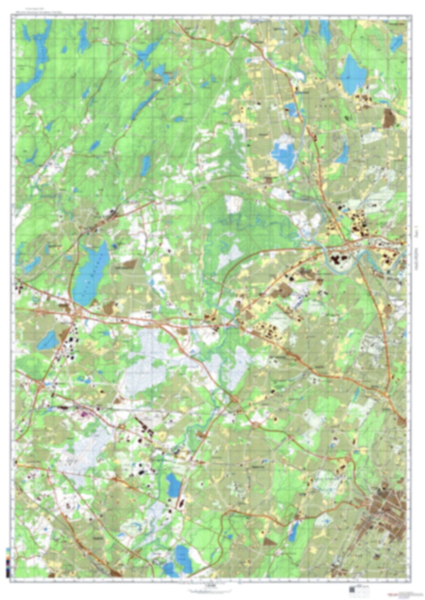
- During the Cold War and before easy access to high-resolution satellite imagery, The Soviet Military was secretly mapping the entire world. These aesthetically striking maps are beautiful down to the last detail and fantastic wall art and until now, have rarely been viewed or available to outsiders. This series has been covered by Wired Magazine and Greg Miller in his book, "All Over the Map: A Cartographic Odyssey". This map is part of the Soviet City Plans Series presented by East View, which has the largest collection of Soviet Military City Plans in the world. The Soviet Military City Plan(s) of New York, NY 1 (USA) is one in a series of highly detailed topographic city maps developed by the USSR Ministry of Defense during the Cold War era. These collectable, high resolution print-on-demand editions are delivered on premium, acid-free, matte paper. This item is sheet number 1 in a set of 9 sheet(s) for New York, NY Populated Places: Essex County, Town of Boonton, Township of Boonton, Township of Cedar Grove, Township of City of Orange, Township of East Hanover, Township of Fairfield, Township of Hanover, Township of Little Falls, Township of Livingston, Township of Montville, Township of Parsippany-Troy Hills, Township of Pequannock, Township of South Orange Village, Township of Verona, Township of Wayne, Township of West Caldwell, Township of West Orange Parks and Reservations: Pompton Plains Landmarks and Natural Features: Kakeout Mountain, Mayapple Hill, Packanack Mountain, Packanack Mountain, Pyramid Mountain, Riker Hill, Rock Pear Mountain, Sheep Hill, Stony Brook Mountains, Stony Hill, Toms Point, Towackhow Mountain, Turkey Mountain, Waughaw Mountain Water Bodies: Adams Lake, Birchwood Lake, Cable Lake, Crystal Lake, East Lake, Fayson Lakes, Franklin Lake, Lake Hiawatha, Lake Juliet, Lake Ma-He-Go, Lake Montowac, Lake Parsippany, Lake Ricabear, Little Mitten Lake, Manor Lake, Orange Reservoir, Pines Lake, Roveres Lake, Taylor Lake, Taylortown Reservoir, Toms Lake, Untermeyer Lake, Valley Lake, Valley Spring Lake, Woodland Lake
- Type: Map
- Subtype: City Plan
- Language: Russian
- Publication Date: 1982-06-01
- Scale: 1:25,000
- Regions Covered: Mid-Atlantic/Northeastern U.S., North America
- Countries Covered: United States
- States Covered: New York
- MPN: NEWYORK1
- Folded Size: N/A
- Unfolded Size: 34.2" (W) x 48.2" (H)
- Weight: 4.8 oz