USSR Ministry of Defense
New Haven, CT (USA) - Soviet Military City Plans
New Haven, CT (USA) - Soviet Military City Plans
Regular price
$49.95 USD
Regular price
Sale price
$49.95 USD
Unit price
per
Shipping calculated at checkout.
Couldn't load pickup availability
- SKU: SUAA-NEWHAVEN-P
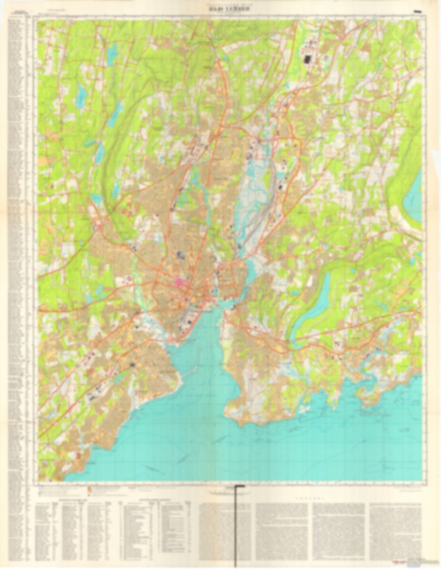
- During the Cold War and before easy access to high-resolution satellite imagery, The Soviet Military was secretly mapping the entire world. These aesthetically striking maps are beautiful down to the last detail and fantastic wall art and until now, have rarely been viewed or available to outsiders. This series has been covered by Wired Magazine and Greg Miller in his book, "All Over the Map: A Cartographic Odyssey". This map is part of the Soviet City Plans Series presented by East View, which has the largest collection of Soviet Military City Plans in the world. The Soviet Military City Plan(s) of New Haven, CT (USA) is one in a series of highly detailed topographic city maps developed by the USSR Ministry of Defense during the Cold War era. These collectable, high resolution print-on-demand editions are delivered on premium, acid-free, matte paper. This item is sheet number 1 in a set of 1 sheet(s) for New Haven, CT Populated Places: City of New Haven, City of West Haven, New Haven County (historical), South Central Connecticut Planning Region, Town of Bethany, Town of Branford, Town of East Haven, Town of Hamden, Town of New Haven, Town of North Haven, Town of West Haven, Town of Woodbridge Military and Defense: Coast Guard Station New Haven Parks and Reservations: West Haven Flats Landmarks and Natural Features: Allington Hill, Baldwin Hill, Baldwin Point, Ball Island, Beacon Hill, Beacon Hill, Big Boil, Bishop Rock, Black Rock, Bradley Point, Branford Hill, Branford Point, Burwell Hill, Burwells Beach, Carrington Hill, Cherry Hill, Cherry Hill, Chidsey Hill, City Point, Clam Island, College Woods, Darrow Rocks, Democrat Rock, Dick Rock, Dragon Point Water Bodies: Branford Cove, Branford Harbor, Farm Brook Reservoir, Granite Bay, Horseshoe Lagoon, Hotchkiss Cove, Indian Lake, Lake Bethany, Lake Dawson, Lake Gaillard, Lake Watrous, Lake Whitney, Lamphier Cove, Lindsey Cove, Maltby Lakes North, Maltby Lakes West, Maltby Lower Lake, Morris Cove, New Haven Harbor, New Haven Harbor Entrance Channel, Pages Cove, Phipps Lake, Shelton Reservoir, Upper Lake Phipps, Upper Lake Phipps
- Type: Map
- Subtype: City Plan
- Language: Russian
- Publication Date: 1977-06-01
- Scale: 1:25,000
- Regions Covered: Mid-Atlantic/Northeastern U.S., North America
- Countries Covered: United States
- States Covered: Connecticut
- MPN: NEW HAVEN
- Folded Size: N/A
- Unfolded Size: 36.3" (W) x 46.9" (H)
- Weight: 4.8 oz