Raven Maps
New England in Context Elevation Tints Fine Art print Map
New England in Context Elevation Tints Fine Art print Map
Couldn't load pickup availability
- SKU: PODRP_NEW_ENG_CNTXT_19X24_WA
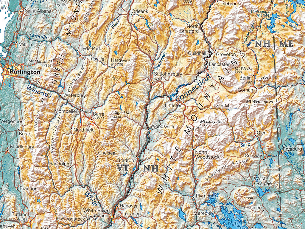
New England is seldom thought of as the Northern Appalachians and their associated coastal plain, but that's a very accurate summary description. Not quite ALL of the northern Appalachians: the western edge of the Taconic mountains still belongs to New York. The mountainous slopes south of the St. Lawrence River Valley are Canadian, and of course New England's coastal towns hardly feel Appalachian at all. But that's the point of this "in context" map series: expanding the viewpoint, getting past unexamined assumptions.
Our latest map in our "States in Context" series covers the six New England states, along with neighboring parts in New York's Hudson River Valley and in Quebec and New Brunswick.
Dimensions: All map dimensions are approximate.
- Type: Flat Map
- Subtype: Wall Art
- Language: English
- Regions Covered: Mid-Atlantic/Northeastern U.S., North America
- Countries Covered: United States
- States Covered: Connecticut, Maine, Massachusetts, New Hampshire, Rhode Island, Vermont
- UPC: 767020013341
- MPN: new-england-in-context-map
- Folded Size: N/A
- Unfolded Size: 19" (W) x 24" (H)
- Finish: Regular Paper