Tom Harrison Maps
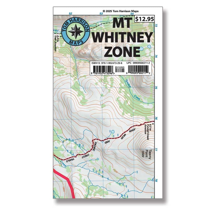
Mt. Whitney Zone Trail Map
Mt. Whitney Zone Trail Map
Couldn't load pickup availability
- SKU: TH_MT_WHIT_ZO_25
The Mt Whitney Zone map covers the entire area around the highest peak in the lower 48. Whether you’re approaching from Whitney Portal, or starting farther south at Horseshoe Meadows, this map provides the detail required. It also shows the route to Mt Langley, as well as the Miter Basin. At 1 inch = 1/2 mile, it offers the highest resolution of any map covering this area. It clearly shows trail mileage and elevation points, along with trailheads, campgrounds, ranger stations, equestrian facilities, bear boxes, forest service roads and more.
Beautiful shaded-relief topo map of Mt Whitney area. GPS-compatible with complete UTM grid. Printed on waterproof and tear resistant material. Scale:1:31,680 (2 inches =1 mile)
- Type: Folded Map
- Subtype: Hiking
- Language: English
- Publication Date: 2025-06-01
- Scale: 1:31,680
- Regions Covered: North America, Western U.S.
- Countries Covered: United States
- States Covered: California
- ISBN: 9781952473296
- UPC: 099095002112
- Folded Size: 4.72" (W) x 8.66" (H)
- Unfolded Size: 25.98" (W) x 18.9" (H)
- Weight: .1 lb