Tom Patterson Maps
Mount Katahdin - Paper
Mount Katahdin - Paper
Regular price
$20.00 USD
Regular price
Sale price
$20.00 USD
Unit price
per
Shipping calculated at checkout.
Couldn't load pickup availability
- SKU: PODTP_KATAHDIN
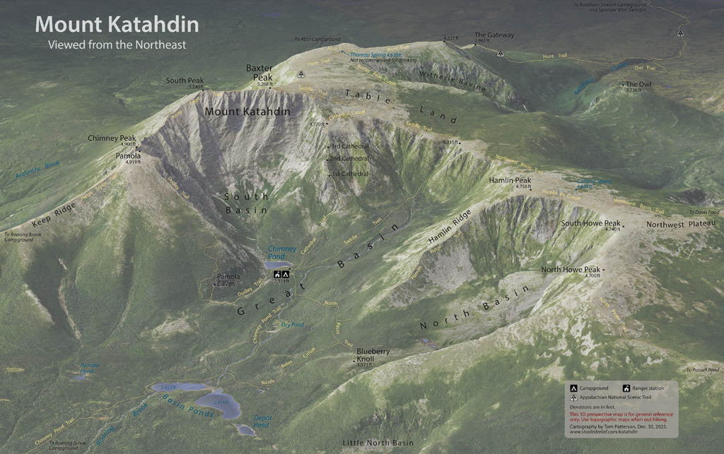
- Looming above the woods and waters of northern Maine, rugged Mount Katahdin looks as if it should belong in the Rockies instead of the rounded Appalachians. It is the final destination of northbound hikers on the Appalachian National Scenic Trail. This 3D perspective map shows the trail network near Chimney Pond, including the famous Knife Edge Trail. Although the map looks photorealistic, it is a digitally-rendered image comprised of geospatial data. Elevations are in feet. Standard Matte Paper (Archival Map Print) Printed on our standard high-quality matte paper, this option offers excellent color accuracy and fine detail with a smooth, non-reflective finish. The matte surface minimizes glare, making it ideal for reading, studying, and framing under glass. FSC-certified and well-suited for both wall display and frequent reference. Best for: Everyday wall maps, educational use, libraries, offices, and framing.
- Subtype: Wall Art
- Language: English
- Folded Size: N/A
- Unfolded Size: 32.5" (W) x 20.9" (H)