Raven Maps
Montana Archival Print
Montana Archival Print
Couldn't load pickup availability
- SKU: PODRP_MT_ARCHVL_16X11
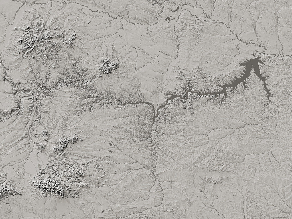
Northwesternmost Montana is drained by the Clark Fork of the Columbia River (including its tributary, the Flathead). Canada's Kootenai River also loops through the northwest corner of the state. Those exceptions aside, Montana is the headwaters of the Mississippi-Missouri system. Ice-age glacial advances have moved the course of the Missouri, the Milk River now occupying an older course north of the Bear Paw Mountains. The Yellowstone and its tributaries define the whole southeastern part of the state.
About Archival Prints
For the lover of landforms, the delicacy and precision of the imagery is what matters. These maps are pure monochrome landform: without the names and built-up areas that appear on our Fine Art Print Landforms and Rivers maps (rivers and streams are shown, but not named). These prints are a revelation, inviting endless contemplation, without distraction.
For a print-lover, the unsurpassed quality and permanence of both paper and inks may be their most important qualities. These special edition archival prints offer unequaled definition and subtlety of tone. Printed in 8 inks on 350g Hahnemühle 100% cotton Museum Etching paper, these are the gold standard.
All map dimensions are approximate. Archival prints are printed at Jeff Gaydash Studios. Please allow three weeks for delivery. Archival prints are non-returnable. Please contact us (info@ravenmaps.com) for samples of archival print paper.
- Type: Flat Map
- Subtype: Wall Art
- Language: English
- Regions Covered: North America, North-central U.S./Great Plains
- Countries Covered: United States
- States Covered: Montana
- UPC: 767020012955
- MPN: montana-archival-print-map
- Folded Size: N/A
- Unfolded Size: 16" (W) x 11" (H)