Latitude 40° Maps
Moab Singletrack Hiking Map
Moab Singletrack Hiking Map
Regular price
$14.95 USD
Regular price
Sale price
$14.95 USD
Unit price
per
Shipping calculated at checkout.
Low stock
Couldn't load pickup availability
- SKU: LAT40_MOAB_SIN_21
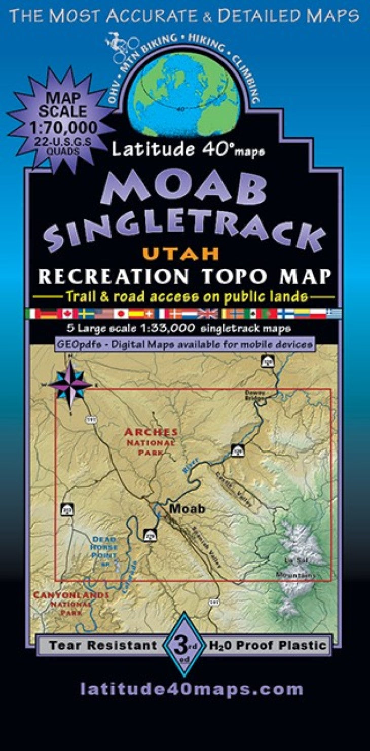
- This map is designed for hikers, equestrians, mtn. bikers, and off roading enthusiasts with an emphasis on foot trails, singletrack and motorized singletrack areas. Over 150 miles of singletrack was constructed on BLM lands by the local trail advocacy group,”Trail Mix”, BLM, professional trail builders and many volunteers between 2008 and 2018. Public access trail and road information is shown for all user groups. Two-sided map covers an area 26.5 miles north to south from Yellow Cat Flat near the northern boundary of Arches NP to Mt. Mellenthin in the central La Sal Mountains. East to west for 41 miles from N. Beaver Mesa/Polar Mesa, west to the intersection of Bartlett Wash Rd. and Dubinky Wash Rd. off of SH 313. The frontside includes 4 enlarged inset maps at 1"= 0.52 miles covering #1 Gemini Bridges Singletrack and "The Magnificent Seven mtb. route" plus Moab Brands, Navajo Rocks, Horsethief, and Amasa Back Trail systems. #2 Sovereign area Trails, Utahraptor State Park and Klonzo Trails-North and South. #3 Dead Horse Point State Park with its mtb. singletrack and foot trails. #4 Klondike Bluffs Area Singletrack and 1 inset at 1"= .28 miles #5 "The Slickrock National Recreation Trail". Trailheads, campgrounds, dispersed camping, picnic areas, day use areas, mtn. huts, cabins, yurts and climbing features/areas. Historical sites, dinosaur fossils and track sites, special geologic areas and scenic viewpoints. The back-side is a regional map of the greater Moab area which includes the infamous, ~27 mile, EPIC "Whole Enchilada Mtb. Route” from the high alpine peaks of the La Sal Mountains to the red rock canyons of the Colorado river, the “Magnificent Seven mtb. route”, plus all areas covered by insets put into a regional context. Reference our regional maps, Moab East Trails and Moab West Trails to connect and follow all routes that extend beyond this maps boundaries. Combine Moab Singletrack or Moab East Trails with Fruita/Grand Junction Trails to cover the entire ~140 mile Kokopelli Trail route from Loma, CO (west of Fruita) to Moab, UT.
- Type: Folded Map
- Subtype: Hiking
- Language: English
- Publication Date: 2021-06-01
- Scale: 1:70,000
- Regions Covered: North America, Western U.S.
- Countries Covered: United States
- States Covered: Utah
- ISBN: 9781879866447
- Folded Size: 4" (W) x 8" (H)
- Unfolded Size: 25" (W) x 39" (H)
- Weight: 3 oz