Latitude 40° Maps
Moab East Trails Hiking Map
Moab East Trails Hiking Map
Regular price
$14.95 USD
Regular price
Sale price
$14.95 USD
Unit price
per
Shipping calculated at checkout.
Couldn't load pickup availability
- SKU: LAT40_MOAB_E_24
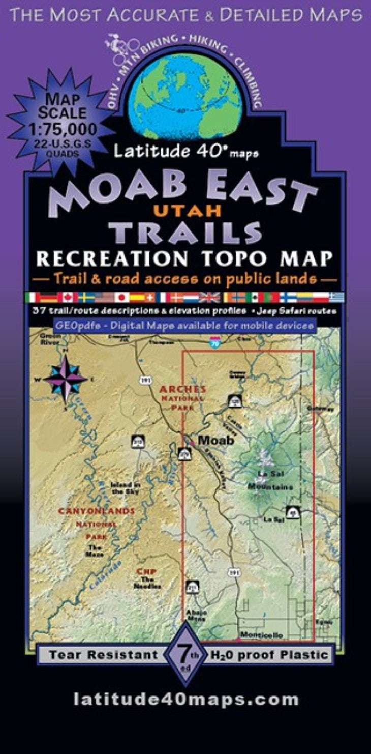
- Anyone who has explored beyond the well known trails close to Moab has most likely had a copy of both Moab East and Moab West in the years since 1992. These maps are often referred to as the "The Bible" for serious trail and route navigation. Public access trail and road information is shown for all user groups. Two-sided map covers 72 miles north to south from ~8 miles north (on SH 128) of Dewey Bridge, UT, south to the town of Monticello, UT. East to west for 31 miles from 2 miles east of the Utah/Colorado border, west to the westside of Moab. The infamous "Whole Enchilada Mtb. Route” with the latest option: Raptor Route Singletrack (~10-12 miles) instead of upper Sand Flats Rd. or Porcupine Rim). Combine Moab East Trails or Moab Singletrack with Fruita/Grand Junction Trails to cover the entire ~140 mile Kokopelli Trail Route from Loma, CO (west of Fruita) to Moab, UT. General information on weather and seasonal hazards, reading maps, getting lost, the fragile desert environment, camping etiquette and preparedness. Includes 37 detailed trail/route descriptions with elevation/distance profiles. Trailheads, campgrounds, dispersed camping, picnic areas, day use areas, parking/pullouts, mtn. huts, cabins and yurts and climbing features/areas. Historical sites, special geologic areas and scenic viewpoints/overlooks. BLM Recreation and Special Recreation areas and Manti La Sal National Forest. Includes Colorado Riverway Recreation Area with Colorado River miles 60-102: put ins/launch sites and take outs, beaches, rapids and designated river camps. Moab East Trails and Moab West Trails, together, side by side cover ~72 miles north to south and ~61 miles east to west - a vast area of canyon country, desert landscapes and the La Sal and Abajo Mountain Ranges surrounding the town of Moab.
- Type: Folded Map
- Subtype: Hiking
- Language: English
- Publication Date: 2024-06-01
- Scale: 1:75,000
- Regions Covered: North America, Western U.S.
- Countries Covered: United States
- States Covered: Utah
- ISBN: 9781879866553
- Folded Size: 4" (W) x 8" (H)
- Unfolded Size: 25" (W) x 39" (H)
- Weight: 3 oz