Rand McNally
Mississippi : state map : easy to read!
Mississippi : state map : easy to read!
Regular price
$5.99 USD
Regular price
Sale price
$5.99 USD
Unit price
per
Shipping calculated at checkout.
Couldn't load pickup availability
- SKU: RM_EASY_MS_9
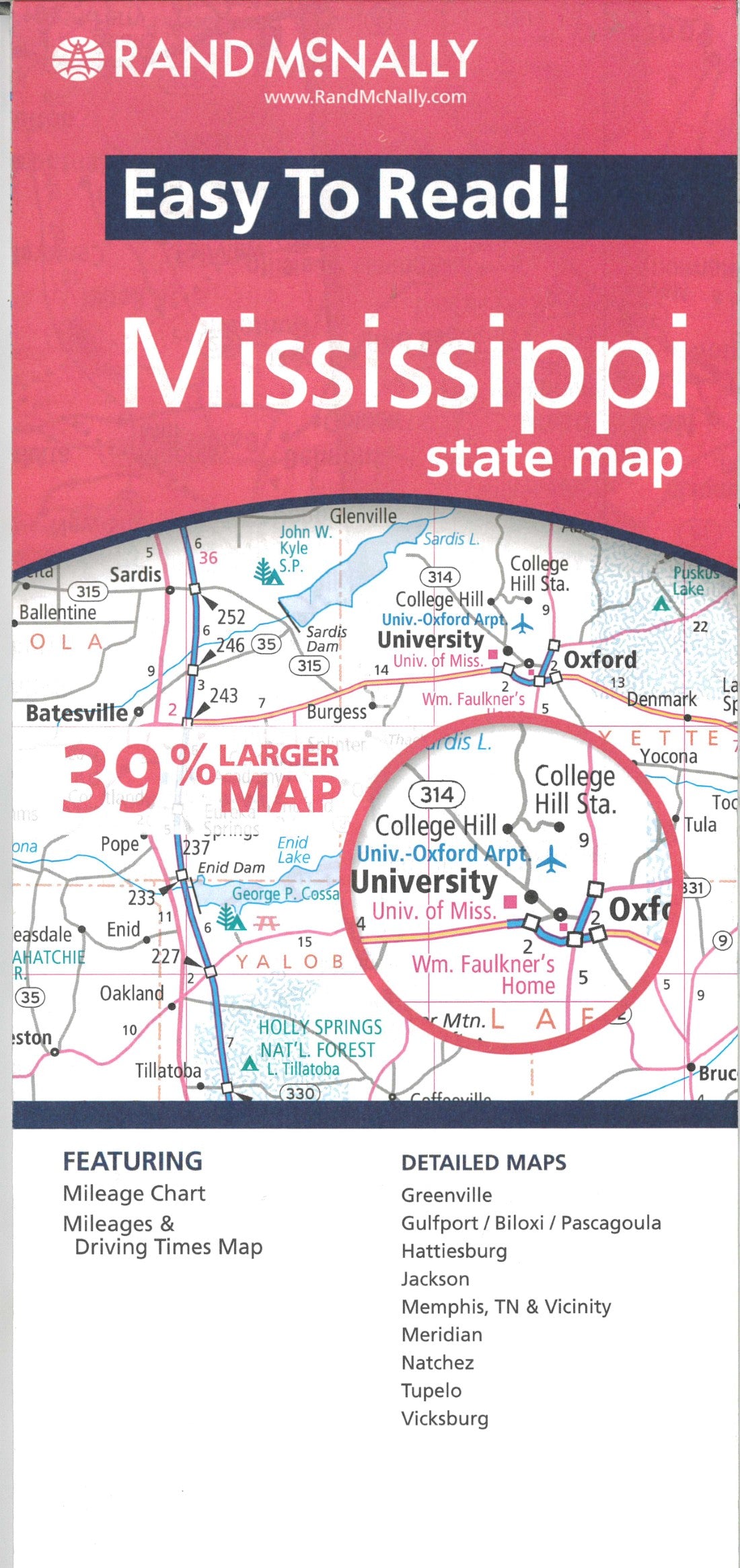
- Rand McNally's Easy To Read State Folded Map is a must-have for anyone traveling in and around Mississippi, offering unbeatable accuracy and reliability at a great price. Our trusted cartography shows all Interstate, U.S., state, and county highways, along with clearly indicated parks, points of interest, airports, county boundaries, and streets. The easy-to-use legend and detailed index make for quick and easy location of destinations. You'll see why Rand McNally folded maps have been the trusted standard for years. 39% larger map with a bigger type size than the Rand McNally Folded Map Clearly labeled Interstate, U.S., state, and county highways Indications of parks, points of interest, airports, county boundaries, and more Mileage and driving times map Detailed index Convenient folded size Detailed maps of: Greenville, Gulfport/Biloxi/Pascagoula, Hattiesburg, Jackson, Memphis, TN & Vicinity, Meridian, Natchez, Tupelo, Vicksburg
- Type: Folded Map
- Subtype: Road
- Language: English
- Publication Date: 2009-06-01
- Scale: 1:506,880
- Countries Covered: United States
- States Covered: Mississippi
- ISBN: 9780528878923
- UPC: 070609878928
- Folded Size: 4.25" (W) x 9.5" (H)
- Unfolded Size: 28" (W) x 40" (H)
- Weight: 1.9 oz