Fishing Hot Spots
Mississippi River-Pool 8 Fishing Map
Mississippi River-Pool 8 Fishing Map
Regular price
$14.95 USD
Regular price
Sale price
$14.95 USD
Unit price
per
Shipping calculated at checkout.
Couldn't load pickup availability
- SKU: FHS_MISS_8_
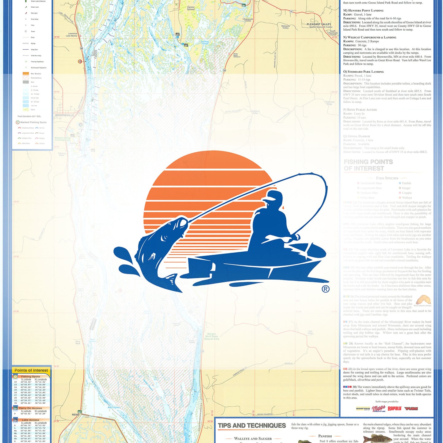
- Pool 8 starts at Lock and Dam 7 and ends at Lock and Dam 8 and is 23.3 miles long. The surface area is roughly 20,180 acres at an elevation of 631.0 feet above MSL (mean sea level). Since this is a river, size and depth will change due to changing water levels and sediment build up. Featured Species: Walleye, Largemouth Bass, Smallmouth Bass, Northern Pike, White Bass, Black Crappie, Perch, Bluegill Map Features: Lake Profile Fishery Information Fishing Tips and Techniques Accesses with Driving Directions 45 Fishing Points of Interest
- Type: Folded Map
- Subtype: Fishing
- Language: English
- Regions Covered: Midwest, North America
- Countries Covered: United States
- States Covered: Minnesota, Wisconsin
- UPC: 071365307332
- MPN: L733
- Folded Size: 6" (W) x 9" (H)
- Unfolded Size: 24" (W) x 36" (H)
- Weight: 2 oz