Fishing Hot Spots
Mississippi River-Pool 10 Fishing Map
Mississippi River-Pool 10 Fishing Map
Regular price
$14.95 USD
Regular price
Sale price
$14.95 USD
Unit price
per
Shipping calculated at checkout.
Couldn't load pickup availability
- SKU: FHS_MISS_10_
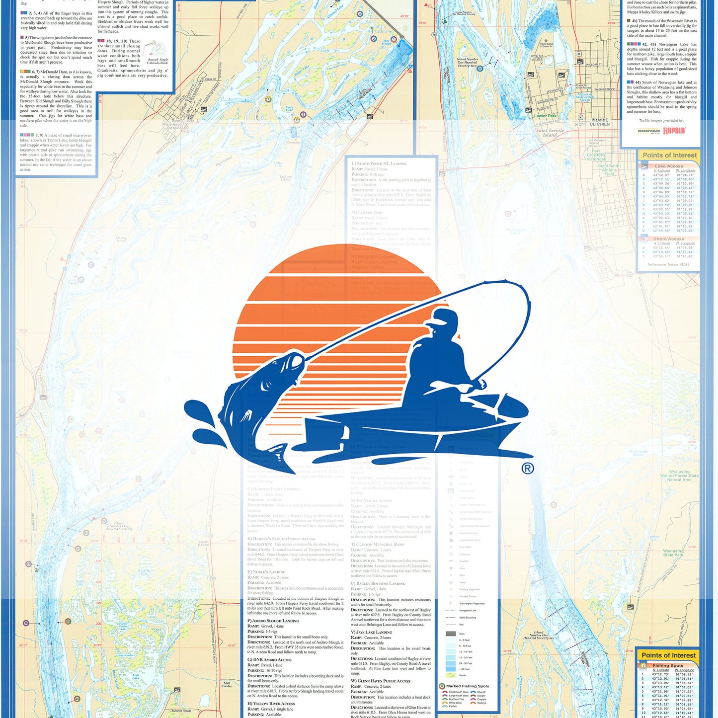
- Pool 10 is approximately 17,070 acres starting at Lock and Dam 9 and ending at Lock and Dam 10, at 32.8 river miles long and 610.0 above MSL (mean sea level). Depths are always changing with water levels. The majority of the water that flows into this pool flows through Dam 9. A major tributary that flows into this pool is the Wisconsin River, which adds a tremendous flow. Featured Species: Walleye, Sauger, Largemouth Bass, White Bass, Black Crappie, Bluegill, Northern Pike Map Features: Lake Profile Fishery Information Fishing Tips and Techniques Accesses with Driving Directions 75 Fishing Points of Interest
- Type: Folded Map
- Subtype: Fishing
- Language: English
- Regions Covered: North America, Southern U.S.
- Countries Covered: United States
- States Covered: Mississippi
- UPC: 071365307318
- MPN: L731
- Folded Size: 6" (W) x 9" (H)
- Unfolded Size: 24" (W) x 36" (H)
- Weight: 2 oz