USSR Ministry of Defense
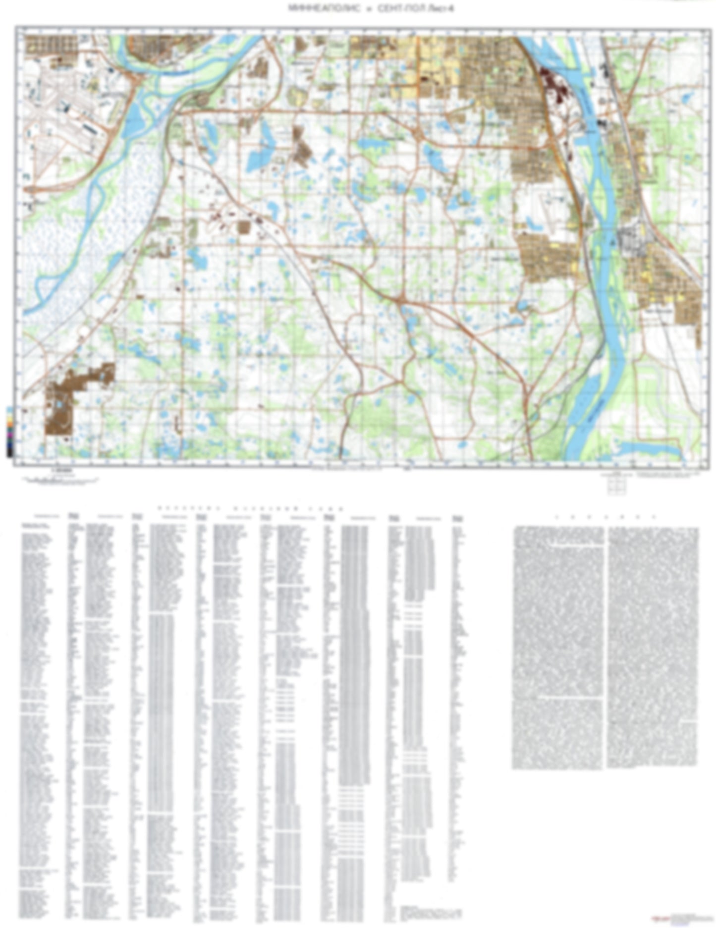
Minneapolis, Saint Paul, MN 4 (USA) - Soviet Military City Plans
Minneapolis, Saint Paul, MN 4 (USA) - Soviet Military City Plans
Regular price
$49.95 USD
Regular price
Sale price
$49.95 USD
Unit price
per
Shipping calculated at checkout.
Couldn't load pickup availability
- SKU: SUAA-MINNEAPOLIS4-P
- During the Cold War and before easy access to high-resolution satellite imagery, The Soviet Military was secretly mapping the entire world. These aesthetically striking maps are beautiful down to the last detail and fantastic wall art and until now, have rarely been viewed or available to outsiders. This series has been covered by Wired Magazine and Greg Miller in his book, "All Over the Map: A Cartographic Odyssey". This map is part of the Soviet City Plans Series presented by East View, which has the largest collection of Soviet Military City Plans in the world. The Soviet Military City Plan(s) of Minneapolis, Saint Paul, MN 4 (USA) is one in a series of highly detailed topographic city maps developed by the USSR Ministry of Defense during the Cold War era. These collectable, high resolution print-on-demand editions are delivered on premium, acid-free, matte paper. This item is sheet number 4 in a set of 4 sheet(s) for Minneapolis, Saint Paul, MN Populated Places: City of Eagan, City of Inver Grove Heights, City of Mendota, City of Mendota Heights, City of Newport, City of Saint Paul Park, City of South Saint Paul, City of Sunfish Lake, City of West Saint Paul, Township of Eagan (historical), Township of Grey Cloud Island, Township of Inver Grove (historical), Unorganized Territory of Fort Snelling Military and Defense: Minneapolis-Saint Paul International Airport Air Reserve Station Landmarks and Natural Features: Pigs Eye Island Number Two, Pike Island, Pilot Knob, Simley Island, Upper Grey Cloud Island Water Bodies: Augusta Lake, Bald Lake, Blackhawk Lake, Carlson Lake, Crosby Lake, Dickman Lake, Fish Lake, Grey Cloud Channel, Gun Club Lake, Hay Lake, Hornbean Lake, Horseshoe Lake, Hurley Lake, Lemay Lake, Lemay Lake, Marcott Lakes, McCarthy Lake, Mooers Lake, O'Leary Lake, Quigley Lake, Ria Lake, River Lake, Rogers Lake, Schmidt Lake, Schwanz Lake, Simley Lake, Snelling Lake, Stark Lake, Sunfish Lake, Upper Lake
- Type: Map
- Subtype: City Plan
- Language: Russian
- Publication Date: 1980-06-01
- Scale: 1:25,000
- Regions Covered: Midwest, North America
- Countries Covered: United States
- States Covered: Minnesota
- MPN: MINNEAPOLIS4
- Folded Size: N/A
- Unfolded Size: 33.3" (W) x 43.1" (H)
- Weight: 4.8 oz