USSR Ministry of Defense
Minneapolis, Saint Paul, MN 2 (USA) - Soviet Military City Plans
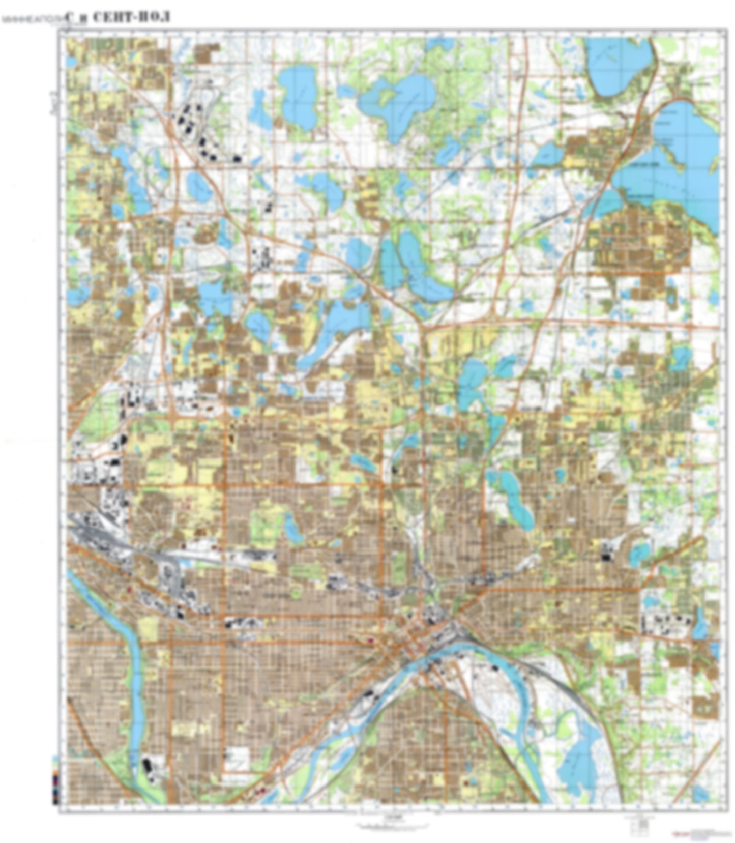
Minneapolis, Saint Paul, MN 2 (USA) - Soviet Military City Plans
Regular price
$49.95 USD
Regular price
Sale price
$49.95 USD
Unit price
per
Shipping calculated at checkout.
Couldn't load pickup availability
- SKU: SUAA-MINNEAPOLIS2-P
- During the Cold War and before easy access to high-resolution satellite imagery, The Soviet Military was secretly mapping the entire world. These aesthetically striking maps are beautiful down to the last detail and fantastic wall art and until now, have rarely been viewed or available to outsiders. This series has been covered by Wired Magazine and Greg Miller in his book, "All Over the Map: A Cartographic Odyssey". This map is part of the Soviet City Plans Series presented by East View, which has the largest collection of Soviet Military City Plans in the world. The Soviet Military City Plan(s) of Minneapolis, Saint Paul, MN 2 (USA) is one in a series of highly detailed topographic city maps developed by the USSR Ministry of Defense during the Cold War era. These collectable, high resolution print-on-demand editions are delivered on premium, acid-free, matte paper. This item is sheet number 2 in a set of 4 sheet(s) for Minneapolis, Saint Paul, MN Populated Places: City of Arden Hills, City of Birchwood Village, City of Falcon Heights, City of Gem Lake, City of Landfall, City of Lauderdale, City of Lilydale, City of Little Canada, City of Maplewood, City of Mounds View, City of New Brighton, City of North Oaks, City of North Saint Paul, City of Roseville, City of Saint Anthony, City of Saint Paul, City of Shoreview, City of Vadnais Heights, City of White Bear Lake, Ramsey County, Township of White Bear Military and Defense: Twin Cities Army Ammunition Plant Landmarks and Natural Features: Harriet Island, Manitou Island, Pigs Eye Island Number One, Raspberry Island Water Bodies: Beaver Lake, Birch Lake, Casey Lake, Charley Lake, Deep Lake, Gem Lake, Goose Lake, Grass Lake, Island Lake, Keller Lake, Lake Como, Lake Johanna, Lake Jones, Little Lake Johanna, Pickerel Lake, Pigs Eye Lake, Pleasant Lake, Pool 1, Round Lake, Savage Lake, Snail Lake, Spoon Lake, Tanners Lake, Wakefield Lake, White Bear Lake
- Type: Map
- Subtype: City Plan
- Language: Russian
- Publication Date: 1980-06-01
- Scale: 1:25,000
- Regions Covered: Midwest, North America
- Countries Covered: United States
- States Covered: Minnesota
- MPN: MINNEAPOLIS2
- Folded Size: N/A
- Unfolded Size: 35.4" (W) x 40.6" (H)
- Weight: 4.8 oz