USSR Ministry of Defense
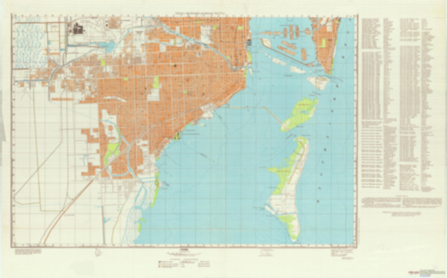
Miami, FL 2 (USA) - Soviet Military City Plans
Miami, FL 2 (USA) - Soviet Military City Plans
Regular price
$49.95 USD
Regular price
Sale price
$49.95 USD
Unit price
per
Shipping calculated at checkout.
Couldn't load pickup availability
- SKU: SUAA-MIAMI2-P
- During the Cold War and before easy access to high-resolution satellite imagery, The Soviet Military was secretly mapping the entire world. These aesthetically striking maps are beautiful down to the last detail and fantastic wall art and until now, have rarely been viewed or available to outsiders This series has been covered by Wired Magazine and Greg Miller in his book, "All Over the Map: A Cartographic Odyssey". This map is part of the Soviet City Plans Series presented by East View, which has the largest collection of Soviet Military City Plans in the world. The Soviet Military City Plan(s) of Miami, FL 2 (USA) is one in a series of highly detailed topographic city maps developed by the USSR Ministry of Defense during the Cold War era. These collectable, high resolution print-on-demand editions are delivered on premium, acid-free, matte paper. This item is sheet number 2 in a set of 2 sheet(s) for Miami, FL Populated Places: City of Coral Gables, City of South Miami, City of West Miami, Key Biscayne Division, Mary Ann Davis Grant Landmarks and Natural Features: Crandon Beach, Dinner Key, Fisher Island, Grove Isle, Harbor Point, Isla Dorada, Isla Grande, Key Biscayne, Mashta Island, Northwest Point, Point View, Sister Banks, Southwest Point, Tahiti Beach, Virginia Beach, Virginia Key, West Point Water Bodies: Bear Cut, Bluebird Lake, Cape Florida Channel, Coral Gables Waterway, Coral Lake, Deering Channel, Dinner Key Channel, Duck Lake, Entrada Channel, Fishermans Channel, Four-Way Channel, Glenvar Lake, Government Cut, Hammock Lake, Ixlater Lake, Lago Maggiore, Lago Minore, Lago Monaco, Lake Catalina, Lake Galloway, Lamar Lake, Miami South Cannel, No Name Harbor, Norris Cut, South Basin, University Lake, Venetian Pool
- Type: Map
- Subtype: City Plan
- Language: Russian
- Publication Date: 1957-06-01
- Scale: 1:25,000
- Regions Covered: North America, Southern U.S.
- Countries Covered: United States
- States Covered: Florida
- MPN: MIAMI2
- Folded Size: N/A
- Unfolded Size: 46.4" (W) x 28.9" (H)
- Weight: 4.8 oz