USSR Ministry of Defense
Mandalay 1 (Myanmar) - Soviet Military City Plans
Mandalay 1 (Myanmar) - Soviet Military City Plans
Regular price
$49.95 USD
Regular price
Sale price
$49.95 USD
Unit price
per
Shipping calculated at checkout.
Couldn't load pickup availability
- SKU: SUAA-MANDALAY1-P
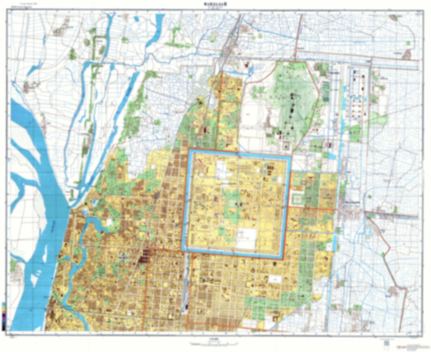
- During the Cold War and before easy access to high-resolution satellite imagery, The Soviet Military was secretly mapping the entire world. These aesthetically striking maps are beautiful down to the last detail and fantastic wall art and until now, have rarely been viewed or available to outsiders. This series has been covered by Wired Magazine and Greg Miller in his book, "All Over the Map: A Cartographic Odyssey". This map is part of the Soviet City Plans Series presented by East View, which has the largest collection of Soviet Military City Plans in the world. The Soviet Military City Plan(s) of Mandalay 1 (Myanmar) is one in a series of highly detailed topographic city maps developed by the USSR Ministry of Defense during the Cold War era. These collectable, high resolution print-on-demand editions are delivered on premium, acid-free, matte paper. This item is sheet number 1 in a set of 2 sheet(s) for Mandalay Populated Places: Ahr Laung Lay, Aung Chan Thar, Bagan Tat, Done Kone, Kan Kaw Ywar Haung, Kan Thit kone, Kangauk, Khangon, Kyan Khin, Kyaung Gyi Su, Kywe Yae Kone, Min Ye Hla, Nan U Lwin, Nyaunggwe, Setyeit, Tei Tar, Tha Min Chan North, Tha Min Chan South, Tha Yet Ta Pin, Thanbogyun, Tu Kone, Waw Tet, Ye Htut, Yenanzu, Zee Pin Kone
- Subtype: City Plan
- Language: Russian
- Publication Date: 1978-06-01
- Scale: 1:10,000
- Countries Covered: Myanmar (Burma)
- MPN: MANDALAY1
- Folded Size: N/A
- Unfolded Size: 37.4" (W) x 30.5" (H)
- Weight: 4.8 oz