USSR Ministry of Defense
Lorient (France) - Soviet Military City Plans
Lorient (France) - Soviet Military City Plans
Regular price
$49.95 USD
Regular price
Sale price
$49.95 USD
Unit price
per
Shipping calculated at checkout.
Couldn't load pickup availability
- SKU: SUAA-LORIENT-P
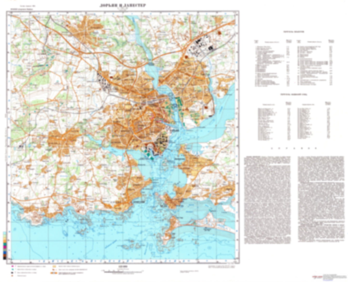
- During the Cold War and before easy access to high-resolution satellite imagery, The Soviet Military was secretly mapping the entire world. These aesthetically striking maps are beautiful down to the last detail and fantastic wall art and until now, have rarely been viewed or available to outsiders. This series has been covered by Wired Magazine and Greg Miller in his book, "All Over the Map: A Cartographic Odyssey". This map is part of the Soviet City Plans Series presented by East View, which has the largest collection of Soviet Military City Plans in the world. The Soviet Military City Plan(s) of Lorient (France) is one in a series of highly detailed topographic city maps developed by the USSR Ministry of Defense during the Cold War era. These collectable, high resolution print-on-demand editions are delivered on premium, acid-free, matte paper. This item is sheet number 1 in a set of 1 sheet(s) for Lorient Populated Places: Ban-Gavres, Gavres, Kercaves, Kerderff, Kerfichant, Kergantic, Kergroise, Kerledern, Kernevel, Kervaugam, Kervern, Kervernois, Keryvaland, La Nourriguel, Lanester, Larmor-Plage, Le Menez, Locmalo, Mene Guen, Ploemeur, Porh-Guer, Port-Louis, Quehellio-Sachoy, Riantec, Trefaven Military and Defense: Lorient Lann Bihoue Landmarks and Natural Features: Beg-er-Men, Ile aux Souris, Ile de Kerner, Ile Saint-Michel, Pen-Mane, Plage de Kerguelen, Plage de Larmor, Plage de Toulhars, Pointe de Gavres, Pointe de Keroman, Pointe de Kerzo, Pointe de l'Esperance, Pointe de Pen-Mane, Pointe du Malheur, Pointe du Talut Water Bodies: Anse de Driasker, Anse de Goerem, Anse de Kerguelen, Anse de Kerroc'h, Anse de Stole, Baie de Locmalo, Etang du Ter, Le Petit Port, Port de la Pointe, Port de Peche, Port Maria
- Subtype: City Plan
- Language: Russian
- Publication Date: 1989-06-01
- Scale: 1:25,000
- Countries Covered: France
- MPN: LORIENT
- Folded Size: N/A
- Unfolded Size: 29.3" (W) x 23.7" (H)
- Weight: 4.8 oz