Trekking Chile
Lonquimay - Conguillío, Travel and Trekking Map
Lonquimay - Conguillío, Travel and Trekking Map
Regular price
$24.95 USD
Regular price
Sale price
$24.95 USD
Unit price
per
Shipping calculated at checkout.
Low stock
Couldn't load pickup availability
- SKU: TC_LON_17
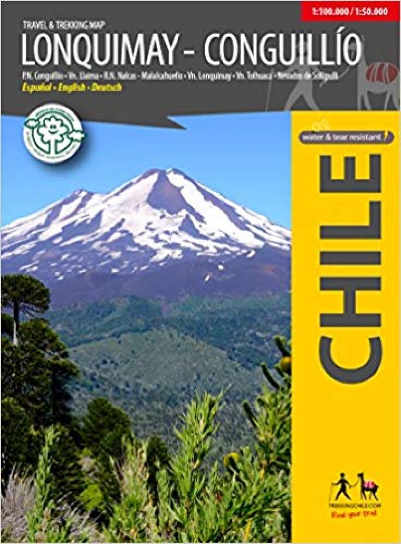
- A completely renovated map that merges two previous titles into one! It includes: the Tolhuaca National Park and the Nalcas - Malalcahuello Reserve with the volcanoes Tolhuaca (2806 m) and Lonquimay (2865 m) the National Park Conguillío, with the volcano Llaima (3125 m) and Sierra Nevada (2554 m) the Nevados of Sollipulli (2282 m). the sources of the Bío Bío River with the Galletué and Icalma lakes. Cartography comes with a general map scale 1: 100,000 and two zooms of 1: 50,000 for the RN Nalcas - Malalcahuello and the PN Conguillío, respectively. Lines of height every 50 m, grid compatible with GPS. With trekking and hiking routes, thermal baths, lodges, campsites, etc. Photos of attractions and drawings of the local fauna. Trekkingchile, 2nd edition 2017 Tourist and trekking map, Southern Chile, scale 1: 100,000 / 1: 50,000 Printed on Stone Paper, resistant to breakage and water, ecological. Spanish - English - German.
- Type: Folded Map
- Subtype: Travel
- Language: English, German, Spanish
- Publication Date: 2017-06-01
- Scale: 1:100,000
- Regions Covered: Patagonia, South America
- Countries Covered: Chile
- ISBN: 9789568925420
- MPN: TR-LQ
- Folded Size: 5" (W) x 7" (H)
- Unfolded Size: 40" (W) x 27" (H)
- Weight: 3.9 oz