USSR Ministry of Defense
Little Rock and North Little Rock, AR (USA) - Soviet Military City Plans
Little Rock and North Little Rock, AR (USA) - Soviet Military City Plans
Regular price
$49.95 USD
Regular price
Sale price
$49.95 USD
Unit price
per
Shipping calculated at checkout.
Couldn't load pickup availability
- SKU: SUAA-LITTLE_ROCK-P
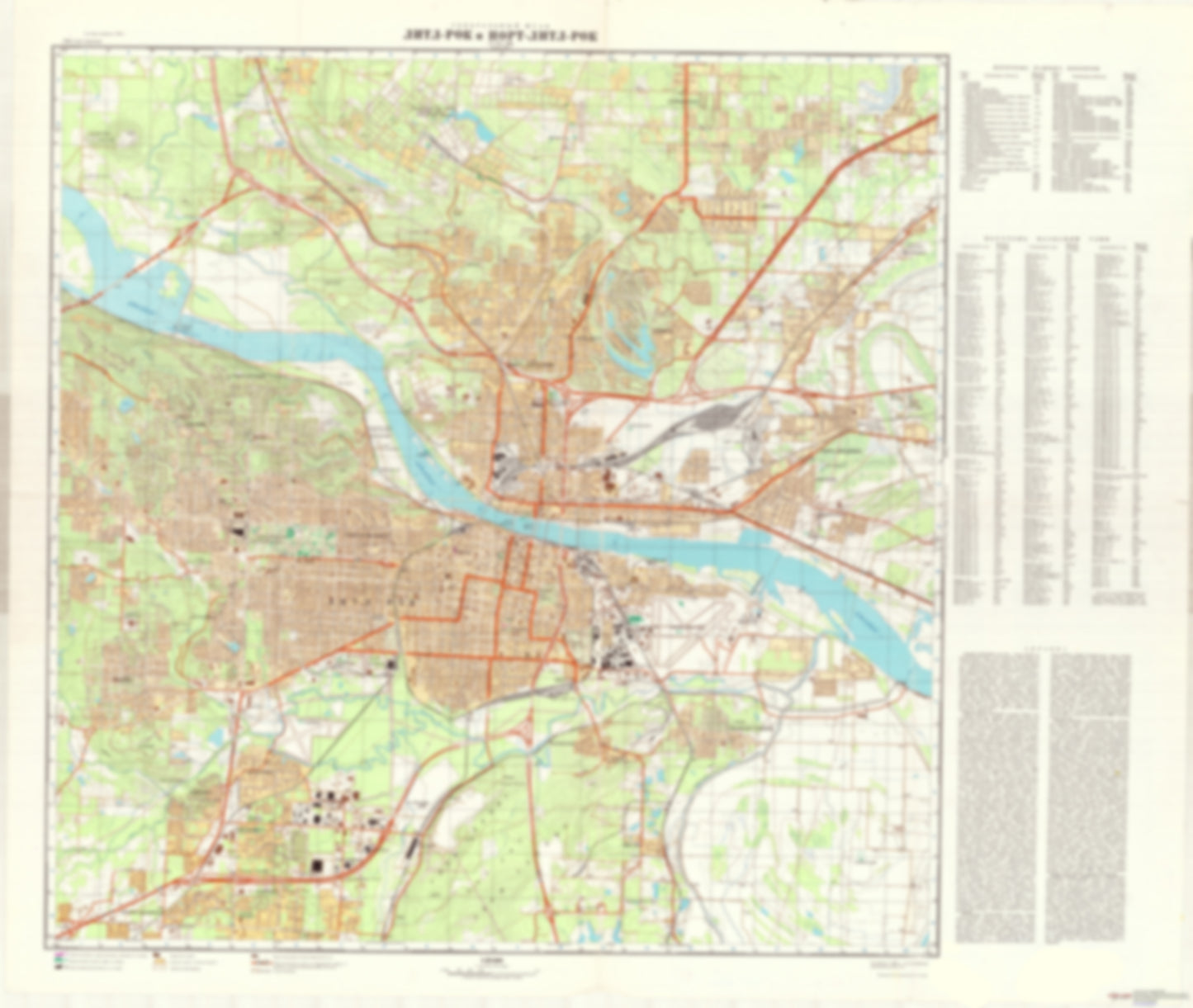
- During the Cold War and before easy access to high-resolution satellite imagery, The Soviet Military was secretly mapping the entire world. These aesthetically striking maps are beautiful down to the last detail and fantastic wall art and until now, have rarely been viewed or available to outsiders. This series has been covered by Wired Magazine and Greg Miller in his book, "All Over the Map: A Cartographic Odyssey". This map is part of the Soviet City Plans Series presented by East View, which has the largest collection of Soviet Military City Plans in the world. The Soviet Military City Plan(s) of Little Rock and North Little Rock, AR (USA) is one in a series of highly detailed topographic city maps developed by the USSR Ministry of Defense during the Cold War era. These collectable, high resolution print-on-demand editions are delivered on premium, acid-free, matte paper. This item is sheet number 1 in a set of 1 sheet(s) for Little Rock and North Little Rock, AR Populated Places: City of Cammack Village, City of Little Rock, City of North Little Rock, Pulaski County, Township of Badgett (historical), Township of Eastman (historical), Township of Hill Parks and Reservations: Brushy Island, Dark Hollow Landmarks and Natural Features: Allis Mountain, Big Rock Mountain, Ermentraudt Mountain, Gates Island, Padgett Hill, Picron Hill, Round Hill Water Bodies: Big Dickinson Lake, Broadmoor Lake, Camp Robinson Lake Number One, Camp Robinson Lake Number Two, Foreman Lake, Hudmans Lake Number One, Hudmans Lake Number Two, Indianhead Lake, Jackson Reservoir, Lake Bendine, Lake Cherrywood, Lake Number One, Lake Number Six, Lake Number Three, Lake Number Two, Lakewood Lake Number One, Little Indian Lake Number One, Little Indian Lake Number Two, Matthews Lake, Peeler Lake, Rosenbaum Lake, Second Edition Lake, Tall Timber Lake, Trammel Lake, Twin Lakes, Western Hills Lake, Wingate Lake
- Subtype: City Plan
- Language: Russian
- Publication Date: 1976-06-01
- Scale: 1:25,000
- Countries Covered: United States
- MPN: LITTLE_ROCK
- Folded Size: N/A
- Unfolded Size: 42.6" (W) x 36" (H)
- Weight: 4.8 oz