Longitude Maps
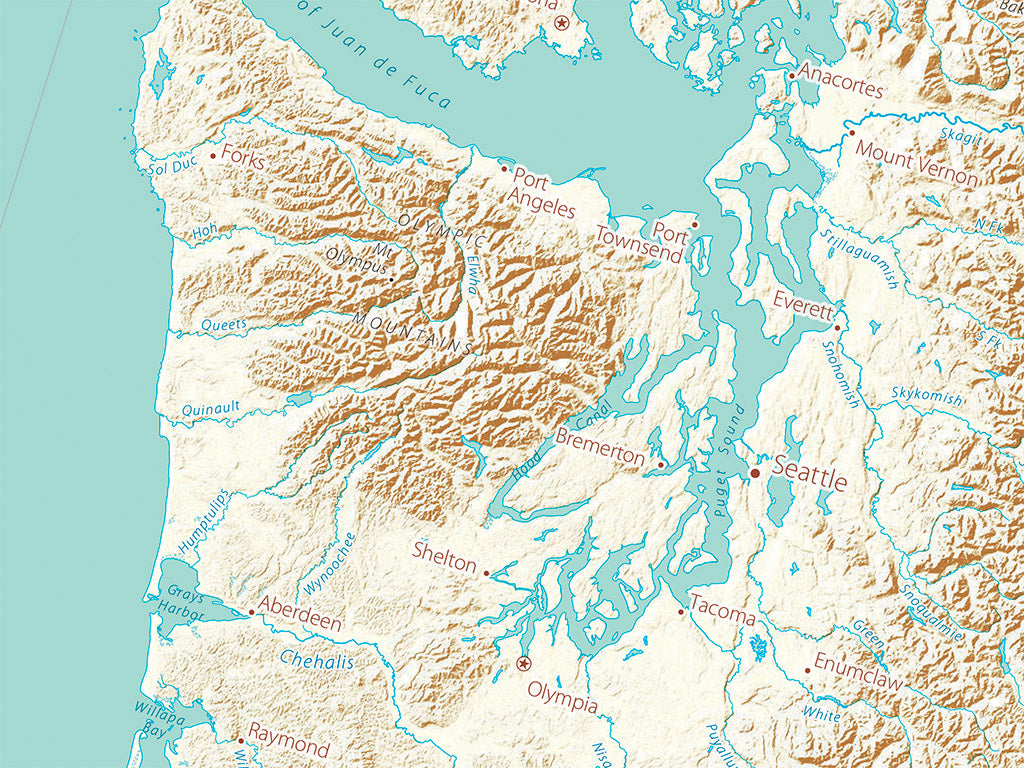
Landforms of the West Coast Fine Art Print Map
Landforms of the West Coast Fine Art Print Map
Couldn't load pickup availability
- SKU: PODRP_WEST_COAS_LF_17X38_WA
The Canadian Coast Ranges continue across the border as the North Cascades, the Cascades, and the Sierra Nevada, separated by a series of structural valleys from the coast ranges. The dominating north-south orientation shifts abruptly at the Transverse Ranges in southern California due to the Pacific tectonic plate’s change in direction (reflected in the Gulf of California rift opening).
The San Andreas system is currently active, but signs of past (and possible future) comparable activity are evident throughout the West. Visible lineations extend over great distances: consider Baja California’s San Pedro Mountains, the east front of the Sierra, through Lake Tahoe and the Warner Mountains. Utah’s Wasatch Range points straight at the Lemhi and Bitterroot valleys and the great Alaska Trench.This map includes the three West Coast states, nearly all of Nevada, significant portions of Idaho, Arizona, and adjacent Mexican and Canadian territory. Coastal Southern California looks very different when seen as the northern end of Baja California.
Dimensions: All map dimensions are approximate.
- Type: Flat Map
- Subtype: Wall Art
- Regions Covered: North America, Pacific U.S., Western U.S.
- Countries Covered: United States
- States Covered: California, Oregon, Washington
- UPC: 767020016113
- MPN: Landforms-of-the-West-Coast-fine-art-print-map
- Folded Size: N/A
- Unfolded Size: 17" (W) x 38" (H)
- Finish: Regular Paper