Longitude Maps
Landforms of the Southern Plains Fine Art Print Map
Landforms of the Southern Plains Fine Art Print Map
Couldn't load pickup availability
- SKU: PODRP_S_PLAINS_LF_24X29_WA
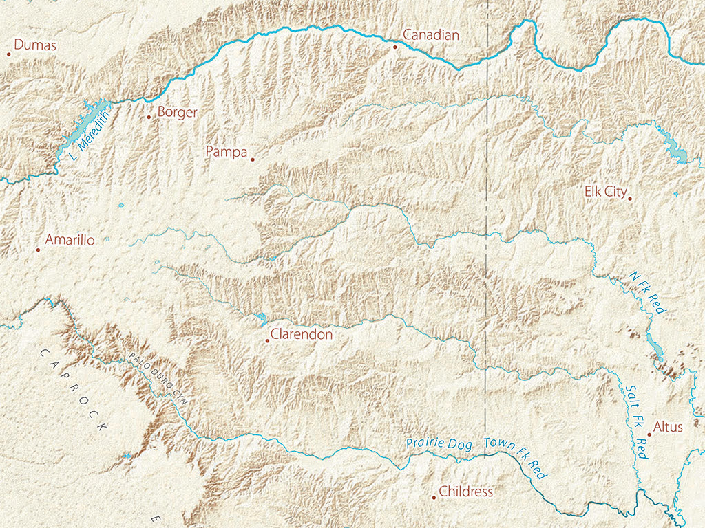
The western boundary of the Southern Plains is marked by the easternmost outlying ranges of the Southern Rockies, drained by the upper Canadian and the Pecos. A broad belt of smooth and geologically young sedimentary beds, these high plains are bordered on the east by the abrupt Caprock Escarpment (and other less dramatic breaks), revealing progressively older rock sequences that finally end in the varied Ozark, Ouchita and other smaller highlands, or in the broad coastal plain.
The Region is characterized by the largely concentric sweeping arcs of very long rivers tending east and south, flowing from the Rockies in the north, and from the high plains in the south. There are no significant natural lakes in the Southern Plains, but reservoirs have transformed its river landscape.
This map covers all of the Rio Grande Basin, from the Rockies in Southern Colorado to the Gulf of Mexico, and including most of the Rio Grande’s basin in northern Mexico. Nearly all of the Arkansas River is included on the north, and the Ozark Plateau and Ouachita Mountains on the east. The map includes all of Texas and Oklahoma, most of New Mexico, a lot of Colorado, Kansas, and Arkansas as well as northern Mexico.
Dimensions: All map dimensions are approximate.
- Type: Flat Map
- Subtype: Wall Art
- Regions Covered: North America, Southern U.S.
- Countries Covered: United States
- States Covered: New Mexico, Oklahoma, Texas
- UPC: 767020014942
- MPN: landforms-of-the-southern-plains
- Folded Size: N/A
- Unfolded Size: 24" (W) x 29" (H)
- Finish: Regular Paper