Raven Maps
Land Cover of the Southern Rockies Fine Art Print Map
Land Cover of the Southern Rockies Fine Art Print Map
Couldn't load pickup availability
- SKU: PODRP_SO_ROCKY_LC_24X30_WA
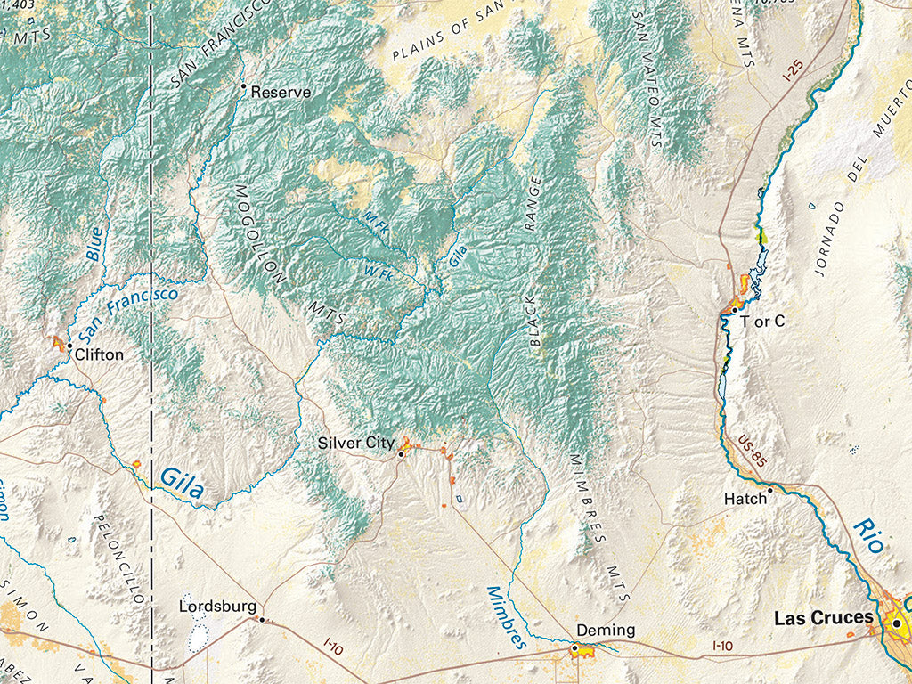
The Southern Rockies south of Wyoming’s Great Divide Basin are markedly scattered and distinct ranges, typically separated by wide grassland and shrub plateaus. Farmlands occupy isolated pockets of suitable land where irrigation water is available. Settlement is concentrated at the region’s very edges, along the Wasatch and Rocky Mountain Fronts and below the Mogollon Rim in Arizona, vast areas are unpopulated.
The Wasatch and numerous Western Colorado Ranges support mixed evergreen & deciduous forests, rather than the evergreen forests seen in most of the West.
The map includes all of Utah, Colorado, Arizona, and New Mexico, most of Wyoming, a lot of Nevada, and smaller portions of neighboring states and Mexico.
Dimensions: All dimensions are approximate.
- Type: Flat Map
- Subtype: Wall Art
- Language: English
- Regions Covered: Central U.S., North America, Southern U.S., Southwestern U.S., Western U.S.
- Countries Covered: United States
- States Covered: Arizona, Colorado, New Mexico, Utah
- UPC: 767020015284
- MPN: land-cover-of-the-southern-rockies-map
- Folded Size: N/A
- Unfolded Size: 24" (W) x 30" (H)
- Finish: Regular Paper