Raven Maps
Land Cover of the South Atlantic States Fine Art Print Map
Land Cover of the South Atlantic States Fine Art Print Map
Couldn't load pickup availability
- SKU: PODRP_S_ATL_COAST_LC_23X36_WA
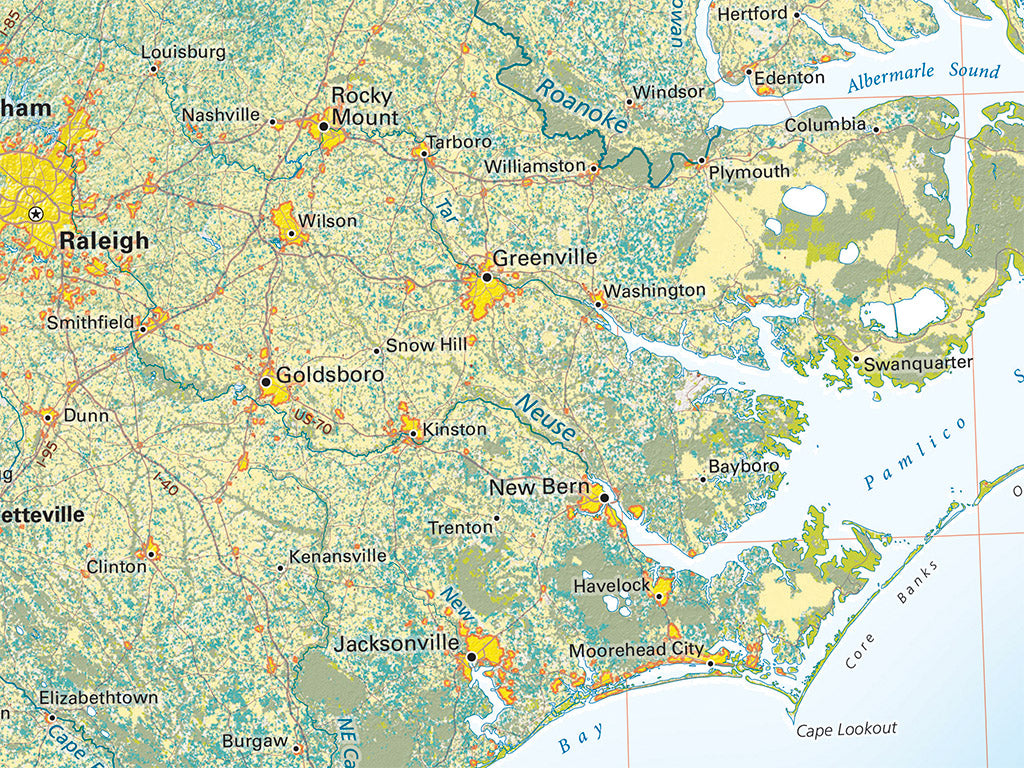
South Atlantic regional landcover displays a sequence of more or less parallel bands: in the mid-Piedmont, a belt of mixed farmland and forest, now heavily urbanized; then, below the intermediate Pine Belt, a similar mixed zone in the upper Coastal Plain, with cities arrayed along the Fall Line. The Low Country of the coastal plains has a higher percentage of forest cover, and, finally, the Sea Islands, a unique coastal wetland province. Urbanization has transformed the Florida Peninsula, spreading across former farmlands and wetland margins and dominating most of that coastline.
This map covers all of the Florida Peninsula, extending west to the Apalachicola River. In the Atlantic we include the Bahamas south and east as far as Great Exuma Island. The Atlantic Coast is shown north up to the Virginia state line and includes all of North Carolina, South Carolina, Georgia, and most of Florida (the western Panhandle is NOT included), eastern Tennessee, and the eastern edge of Alabama.
Dimensions: All dimensions are approximate.
- Type: Flat Map
- Subtype: Wall Art
- Language: English
- Regions Covered: North America, Southern U.S.
- Countries Covered: United States
- States Covered: Florida, Georgia, North Carolina, South Carolina
- UPC: 767020014836
- MPN: land-cover-of-the-south-atlantic-states-map
- Folded Size: N/A
- Unfolded Size: 23" (W) x 36" (H)
- Finish: Regular Paper