Raven Maps
Land Cover of the Mid-Atlantic Coast Fine Art Print Map
Land Cover of the Mid-Atlantic Coast Fine Art Print Map
Couldn't load pickup availability
- SKU: PODRP_MID_ATL_LC_19X30_WA
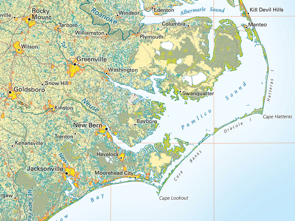
The Mid-Atlantic Region is dominated in most areas by mixed deciduous woodlands and forests. Evergreen forests fade in importance from south to north, with prominent exceptions in the New Jersey Pine Barrens and the Adirondacks of New York. Farmlands are found everywhere, but for the most part scattered, as the farming economy has left less productive land and the car and rising populations have spread urbanization across formerly agricultural lowlands.
This map includes all of the coast from the western edge of Narraganset Bay south to Santee Point in South Carolina. Coverage includes all of Connecticut, New Jersey, Pennsylvania, Maryland, and Delaware, along with most of New York, Massachusetts, and eastern Virginia and North Carolina.
Dimensions: All dimensions are approximate.- Type: Flat Map
- Subtype: Wall Art
- Language: English
- Regions Covered: Mid-Atlantic/Northeastern U.S., North America
- Countries Covered: United States
- States Covered: Connecticut, Delaware, Maryland, Massachusetts, New Jersey, New York, Pennsylvania
- UPC: 767020012900
- MPN: land-cover-of-the-mid-atlantic-coast
- Folded Size: N/A
- Unfolded Size: 19" (W) x 30" (H)
- Finish: Regular Paper