Raven Maps
Land Cover of the East Coast Fine Art Print Map
Land Cover of the East Coast Fine Art Print Map
Couldn't load pickup availability
- SKU: PODRP_EAST_COAS_LC_35X69_WA
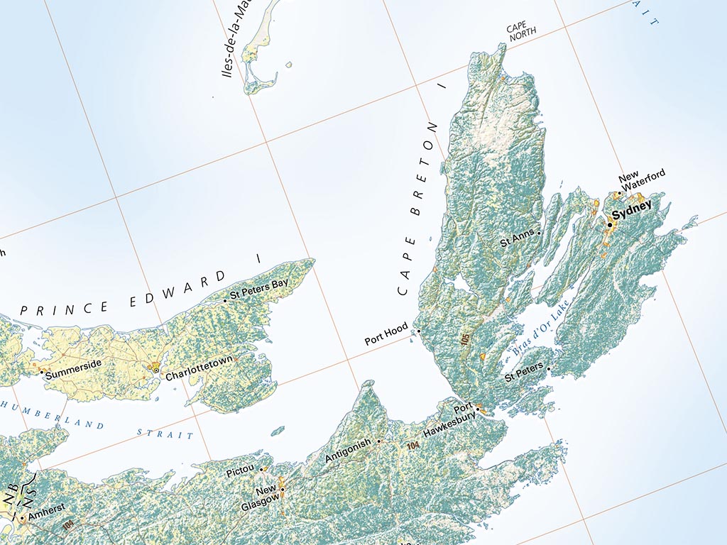
East Coast Land Cover categories range from sub-arctic barrens and wetlands in the north to mangrove swamps in subtropical Florida.
The whole region is covered at a larger scale in four larger-scale overlapping maps, but this comprehensive view invites more sweeping comparisons: The Great Lakes and St Lawrence River Valley, dividing the Laurentian Shield from greater Appalachia, is by far the largest farmland block.
Mostly deciduous forests dominate south of the St Lawrence. Evergreen forests of the north country re-appear briefly in New Jersey’s Pine Barrens, then again in parallel belts from Richmond to central Florida. Metro areas have grown nearly completely together from Richmond to Boston, with similar trends under way in the Carolinas and Florida.
The map includes the Florida Peninsula, coastal SE Georgia, and most of the Carolinas, Virginia, and West Virginia. All of the Mid-Atlantic and New England states are shown in their entirety, along with much of Ontario, Quebec, and the Maritime Provinces.
Dimensions: All dimensiona are approximate
- Type: Flat Map
- Subtype: Wall Art
- Language: English
- Regions Covered: Mid-Atlantic/Northeastern U.S., North America, Southern U.S.
- Countries Covered: United States
- States Covered: Connecticut, Delaware, Florida, Maine, Maryland, Massachusetts, New Hampshire, New Jersey, New York, North Carolina, Pennsylvania, Rhode Island, South Carolina, Vermont, Virginia
- UPC: 767020011781
- MPN: land-cover-of-the-east-coast
- Folded Size: N/A
- Unfolded Size: 35" (W) x 69" (H)
- Finish: Regular Paper