Raven Maps
Land Cover of the Central Plains & Prairie Fine Art Print Map
Land Cover of the Central Plains & Prairie Fine Art Print Map
Couldn't load pickup availability
- SKU: PODRP_CENT_PLAINS_LC_37X29_WA
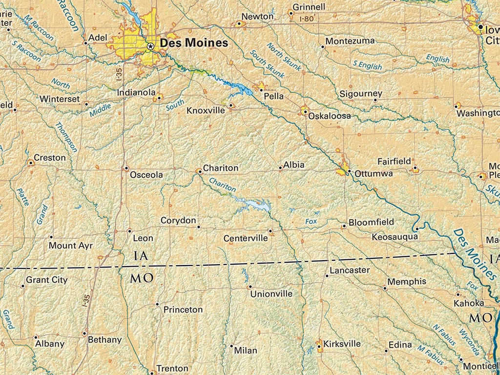
The Central Plains are the core American Farm Belt, extending west from Ohio to Nebraska, Kansas, Oklahoma and the Texas Panhandle, centered on the “I States” of Indiana, Illinois, and Iowa, and including Southern Minnesota.
Rainfall farming on glacial outwash plains supported dense small town settlement in the eastern half of the region, thinning to the west on drier and rougher land. Population is now concentrated in large and mid-sized metro areas as far west as Wichita and Oklahoma City.
The deciduous forests of the Ohio River in the east and the Ozarks in the west mark an indeterminate regional southern borderland.
This map covers the heart of the Central Mississippi Valley, from the Black Hills in the northwest corner to the great bend of the Tennessee River in Alabama. The map includes all of Nebraska, Kansas, Iowa, Missouri, Illinois, and Indiana. Also included are Southern portions of South Dakota, Minnesota, Wisconsin, and western Michigan as well as easternmost Colorado and the Texas Panhandle, nearly all of Oklahoma, Northern Arkansas and western Tennessee and Kentucky.
Dimensions: All map dimensions are approximate.
- Type: Flat Map
- Subtype: Wall Art
- Language: English
- Regions Covered: Central U.S., Midwest, North America, Southern U.S.
- States Covered: Illinois, Indiana, Iowa, Kansas, Missouri, Nebraska, Oklahoma
- UPC: 767020011255
- MPN: land-cover-of-the-central-plains-and-prairie
- Folded Size: N/A
- Unfolded Size: 37" (W) x 29" (H)
- Finish: Regular Paper