Raven Maps
Lake Tahoe Elevation Tints Fine Art Print Map
Lake Tahoe Elevation Tints Fine Art Print Map
Couldn't load pickup availability
- SKU: PODRP_TAHOE_ELEV_16X24_WA
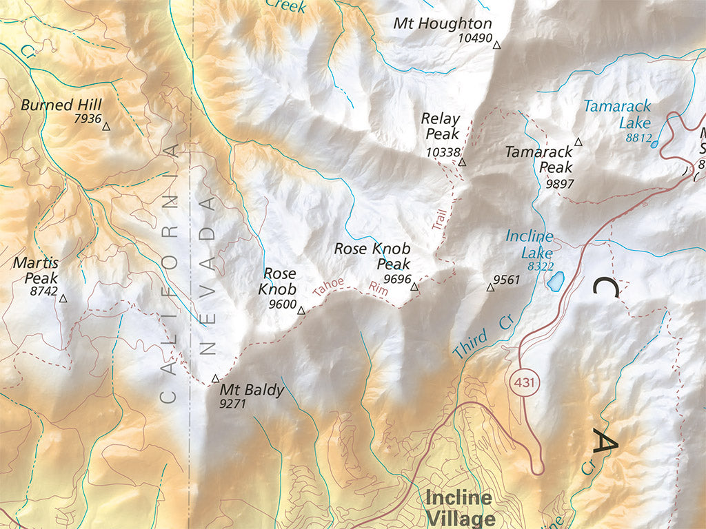
The largest alpine lake on the continent is also the second-deepest lake (of any kind) in the United States, its azure waters filling a grand basin ringed by high peaks. With detailed bathymetry and gorgeous shaded relief, this map offers a sunning illustration of Lake Tahoe and its surroundings. Cities and major roads provide geographic context to spark memories of past adventures in this landscape, and both the Pacific Crest Trail and the Tahoe Rim Trail are included to highlight these popular backcountry corridors.
We have three new versions of this fine art map of Lake Tahoe: Large (45" X 30"), Medium (original size 36" X 24"), and Small (24" X 16")
Dimensions: All map dimensions are approximate.
- Type: Flat Map
- Subtype: Wall Art
- Language: English
- Regions Covered: North America, Western U.S.
- Countries Covered: United States
- States Covered: California, Nevada
- UPC: 767020015345
- MPN: PODRP_TAHOE_ELEV_LG
- Folded Size: N/A
- Unfolded Size: 16" (W) x 24" (H)
- Finish: Regular Paper