Fish-n-Map Company
Lake Sonoma, Mendocino, San Pablo, Del Valle Fishing Map
Lake Sonoma, Mendocino, San Pablo, Del Valle Fishing Map
Couldn't load pickup availability
- SKU: FNM_SMS_PDV_21
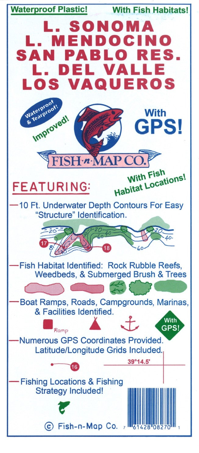
Fish-N-Map Company underwater topography maps are printed on a waterproof, tear-resistant material and are folded to 9" x 4". When opened, each map is approximately 3' x 2' in size and is printed on both sides. These maps feature waterproof plastic "paper"; underwater depth contours; fish locations; latitude and longitude for GPS; often multiple lakes on one map; boat ramps; recreational facilities; and much more.
2021 UPDATES:
Added longitude and latitude grids to all 5 lakes
Added fish habitat to all 5 lakes including submerged rock rubble reefs, submerged brush and weedbeds, and submerged trees
Added onshore trees and brush
Added an additional color - green
Updated facilities, roads and lake outlines
Added all new fishing strategies and fishing suggestions to all 5 lakes
FEATURES:
Printed onto a waterproof, tear-resistant plastic
Two-sided map folds to 9" x 4", unfolds to 3' x 2'
Fish habitat identified: Rock rubble reefs, weedbeds and submerged brush and trees
Fishing locations and fishing strategies included
Numerous GPS coordinates provided with latitude and longitude grids included
10-foot underwater depth contours
Boat ramps, roads, campgrounds, marinas and facilities identified
MADE IN THE U.S.A.- Type: Folded Map
- Subtype: Fishing
- Language: English
- Publication Date: 2021-06-01
- Scale: Scale not provided
- Regions Covered: North America, Western U.S.
- Countries Covered: United States
- States Covered: California
- UPC: 761428082701
- Folded Size: 4" (W) x 9" (H)
- Unfolded Size: 36" (W) x 24" (H)
- Weight: 1.8 oz