Fish-n-Map Company
Lake Mohave Fishing Map
Lake Mohave Fishing Map
Couldn't load pickup availability
- SKU: FNM_LK_MOHAVE_20
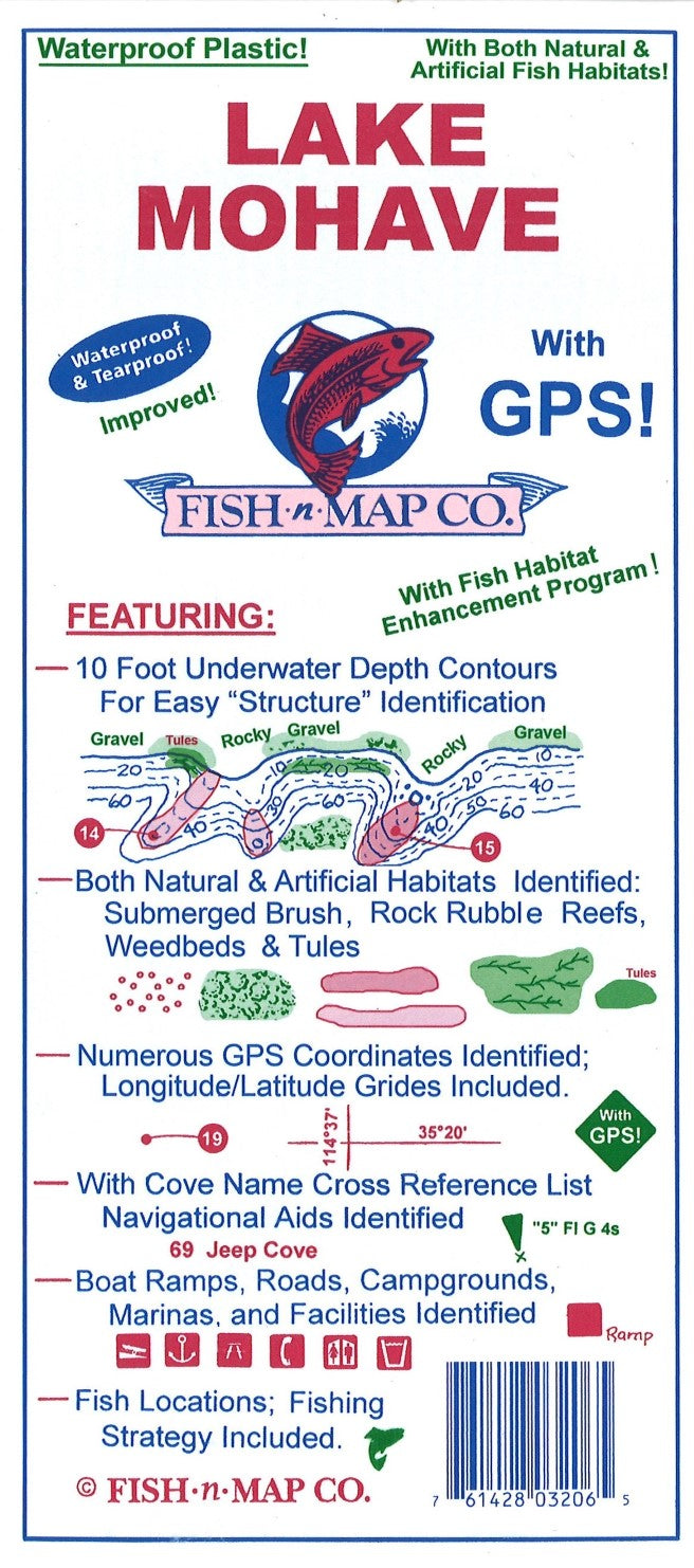
Fish-N-Map Company underwater topography maps are printed on a waterproof, tear-resistant material and are folded to 9" x 4". When opened, each map is approximately 3' x 2' in size and is printed on both sides. These maps feature waterproof plastic "paper"; underwater depth contours; fish locations; latitude and longitude for GPS; often multiple lakes on one map; boat ramps; recreational facilities; and much more.
Updated June 2020
Additions and Improvements:
• Added Fish Habitat:
o Fair Rock Rubble
o Good Rock Rubble
o Submerged Weedbeds
• Updated the outline of the lake and depth contours where needed
• Updated GPS Coordinates
• Updated Fishing Strategy and Fishing Suggestions
• Added onshore brush and trees
• Added shoreline geological features such as “Steep Deep”, “Rocky Gravel”, Slab Rock”, “Gravel”, etc.
• Updated facilities
• Added an additional color to the map – green
ARTIFICIAL HABITAT LOCATIONS UPDATED IN 2016
FEATURES:
10 foot underwater depth contours
GPS locations and fish habitat areas identified. With longitude and latitude grids
Fish locations
Fishing strategy
Submerged brush, roadbeds, houses & buildings, major river channels and feeder creeks identfied
Boat ramps, roads, campgrounds, marinas and facilities shown
Waterproof, tear-resistant. Folds to 9"x4"; unfolds to 3'x2'.
MADE IN THE U.S.A.- Type: Folded Map
- Subtype: Fishing
- Language: English
- Publication Date: 2020-06-01
- Scale: Scale not provided
- Regions Covered: North America, Southwestern U.S.
- Countries Covered: United States
- States Covered: Arizona
- UPC: 761428032065
- Folded Size: 4" (W) x 9" (H)
- Unfolded Size: 36" (W) x 24" (H)
- Weight: 2.8 oz