Fish-n-Map Company
Lake Mead Fishing Map
Lake Mead Fishing Map
Couldn't load pickup availability
- SKU: FNM_LK_MEAD_24
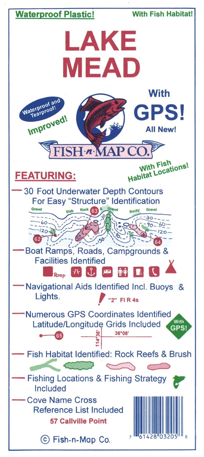
Fish-N-Map Company underwater topography maps are printed on a waterproof, tear-resistant material and are folded to 9" x 4". When opened, each map is approximately 3' x 2' in size and is printed on both sides. These maps feature waterproof plastic "paper"; underwater depth contours; fish locations; latitude and longitude for GPS; often multiple lakes on one map; boat ramps; recreational facilities; and much more.
MAP FEATURES:
Added Fish Habitat including: Moderate Submerged Brush, Heavy Submerged Brush, Fair Rock Rubble Reefs, Good Rock Rubble Reefs and slab rock
Shoreline features: Gravel, Rocky Gravel, Rocky, Slab Rock, Slab Rock and Gravel, Rock Wall and steep deep
Updated Fishing Suggestions and Fishing Strategy to include Fish Habitat
Updated the sediment fill areas of the lake
Updated Marinas, Boat Ramps, Facilities & Telephone Numbers
Added Historic Water Levels for Lake Mead
Added a new color to the map: Green
Underwater topography updated using aerial photos and satellite data
Map is waterproof, tear-resistant, opens to 3' x 2' and folds to 9" x 4" and is printed on two sides.
30-foot underwater depth contours
Numerous GPS coordinates identified, latitude/longitude grids included
Fish Habitat Identified including rock rubble reefs (slab rock, rock rubble - medium and fair), submerged brush and trees
Shoreline Habitat Features Shown
Fishing Locations and Fishing Strategy included
MADE IN THE U.S.A.- Type: Folded Map
- Subtype: Fishing
- Language: English
- Publication Date: 2024-06-01
- Scale: Scales not provided
- Regions Covered: North America, Western U.S.
- Countries Covered: United States
- States Covered: Nevada
- UPC: 761428032058
- Folded Size: 4" (W) x 9" (H)
- Unfolded Size: 36" (W) x 24" (H)
- Weight: 3 oz