Freytag & Berndt
Lake Constance/Bodensee, Panoramic Map
Lake Constance/Bodensee, Panoramic Map
Regular price
$19.95 USD
Regular price
Sale price
$19.95 USD
Unit price
per
Shipping calculated at checkout.
Couldn't load pickup availability
- SKU: FB_CON_LAKE_PAN_20
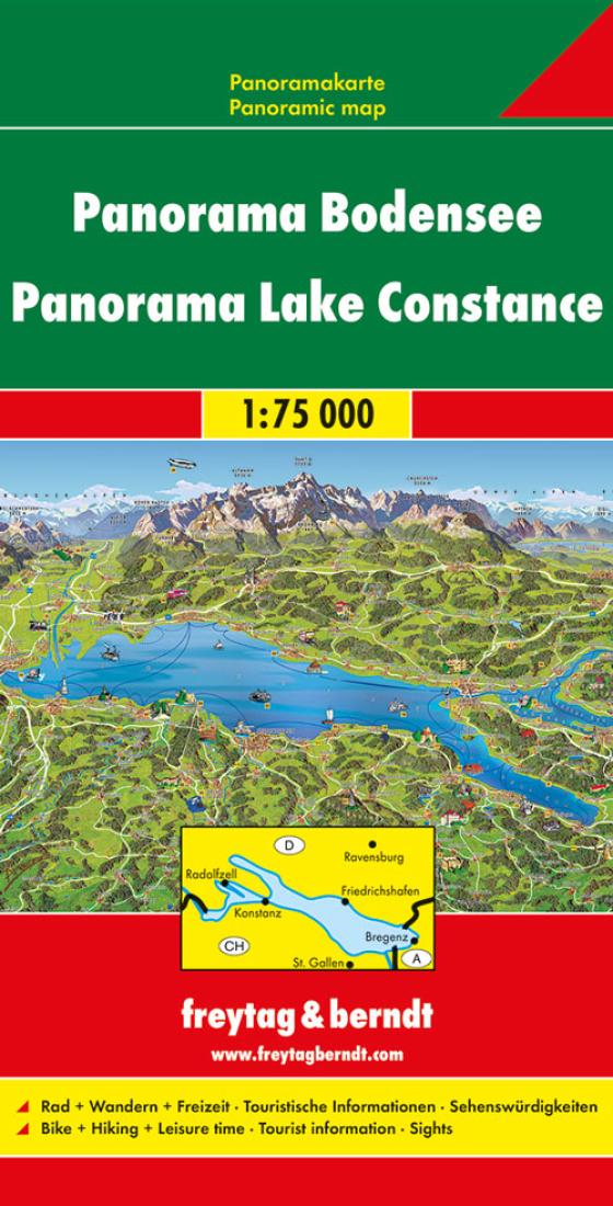
- Lake Constance area at 1:75,000 on a touring and cycling map from Freytag & Berndt prominently highlighting scenic roads and special tourist routes, recommended cycling routes, and locations worth visiting. Coverage extends from north of Ravensburg in Germany to St. Gallen in Switzerland, and includes Bregenz and Dornbirn in Austria. On the reverse of this version is a beautiful, hand-drawn panorama map of the region, looking southwards from Weingarten in Germany towards the peaks of the Swiss Alps, with Säntis in the middle and Lake Zurich with Rigi in the west. Various local attractions and sights are highlighted by small drawings. The main map is also available without the panorama map but with German language descriptions of places of interest. Road network includes small local roads, many shown with driving distances. Scenic roads and special tourist routes are prominently highlighted, as are recommended cycling routes and picturesque local towns. Railway lines are shown with stations and ferry connections on the lake are marked. Icons indicate other places of interest and facilities, including campsites and youth hostels, cultural and historical heritage, beaches and spas, etc. The map has latitude and longitude lines at 5’ intervals. Map legend includes English.
- Type: Folded Map
- Subtype: Travel
- Language: English, German
- Publication Date: 2020-06-01
- Scale: 1:75,000
- Regions Covered: Alps, Central Europe, Europe, Western Europe
- Countries Covered: Austria, Germany, Switzerland
- ISBN: 9783707918427
- Folded Size: 5.12" (W) x 9.84" (H)
- Unfolded Size: 26.77" (W) x 44.09" (H)
- Weight: 3.4 oz