Mapple
Kamikochi, Japan Hiking & Trekking Map - English Edition
Kamikochi, Japan Hiking & Trekking Map - English Edition
Couldn't load pickup availability
- SKU: MAPP_H_KAMI_ENG_25
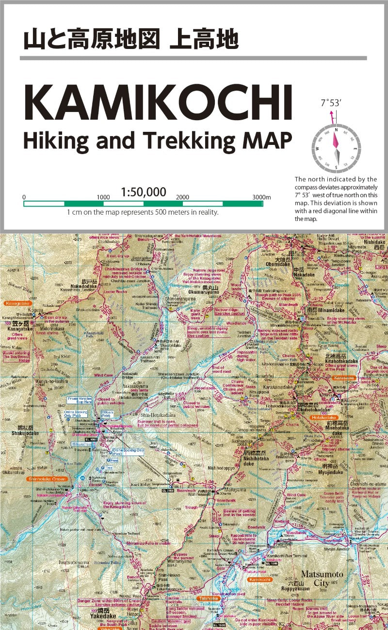
KAMIKOCHI Hiking & Trekking Map – English Edition
Explore Japan's Northern Alps with confidence using the KAMIKOCHI Hiking & Trekking Map – the English-language map, produced by one of Japan’s top map publishers, Mapple, a subdivision of Shobunsha Holdings, Inc.
Coverage Areas:
Mt. Yari & Mt. Hotaka
Mt. Yake & Mt. Tsubakuro
Mt. Jonen & Mt. Kasa
Kamikochi
Mt. Kasumizawa & Mt. Otensho
Designed for Serious Hikers:
Whether you're planning your route or trekking in real time, this map is crafted for practicality and reliability in Japan’s rugged mountain terrain. All trails, huts, water sources, and major landmarks have been verified by on-site surveys. Hazard zones and areas with a high risk of getting lost are clearly marked, and complex intersections are detailed with enlarged maps and helpful illustrations.Navigation Made Easy:
Magnetic north lines are printed at regular intervals, simplifying compass use and declination checks between true and magnetic north.Built for Any Weather:
Printed on durable, water-resistant paper with a varnish finish, this map is tough enough to withstand rain, storms, and repeated use. It won’t tear easily and resists ink smudging, ensuring clear readability in any weather.Get ready for a safe and informed adventure across Japan’s iconic peaks with this essential hiking companion.
- Type: Folded Map
- Subtype: Hiking
- Language: Japanese
- Publication Date: 2025-08-01
- Scale: 1:50,000
- Regions Covered: Asia, East Asia, Pacific Ocean
- Countries Covered: Japan
- States Covered: Nagano
- UPC: 4955477860021
- Folded Size: 6.3" (W) x 10" (H)
- Unfolded Size: 18.5" (W) x 25" (H)
- Weight: 5 oz