Tom Patterson Maps
Kalaupapa National Historical Park - Paper
Kalaupapa National Historical Park - Paper
Regular price
$20.00 USD
Regular price
Sale price
$20.00 USD
Unit price
per
Shipping calculated at checkout.
Couldn't load pickup availability
- SKU: PODTP_KALAUPAPA
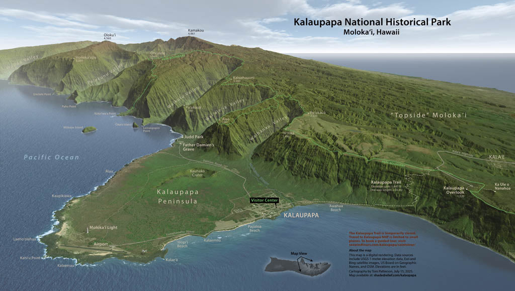
- Located on the north shore of Molokai, Hawaii, this park on an isolated peninsula was once a large leper colony. A handful of patients still remain. Visitor access is only by trail down a steep escarpment. Just beyond the Kalaupapa Peninsula, the highest sea cliffs on Earth rise over 3,000 feet (900 meters) above the Pacific. This photo-realistic 3D map created from digital data captures the magnificent setting. Elevations and distances are in feet and miles. Standard Matte Paper (Archival Map Print) Printed on our standard high-quality matte paper, this option offers excellent color accuracy and fine detail with a smooth, non-reflective finish. The matte surface minimizes glare, making it ideal for reading, studying, and framing under glass. FSC-certified and well-suited for both wall display and frequent reference. Best for: Everyday wall maps, educational use, libraries, offices, and framing.
- Subtype: Wall Art
- Language: English
- Folded Size: N/A
- Unfolded Size: 31" (W) x 18" (H)