USSR Ministry of Defense
Jacksonville, FL 2 (USA) - Soviet Military City Plans
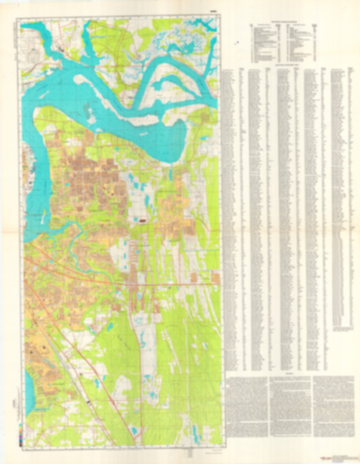
Jacksonville, FL 2 (USA) - Soviet Military City Plans
Regular price
$49.95 USD
Regular price
Sale price
$49.95 USD
Unit price
per
Shipping calculated at checkout.
Couldn't load pickup availability
- SKU: SUAA-JACKSONVILLE-FL2-P
- During the Cold War and before easy access to high-resolution satellite imagery, The Soviet Military was secretly mapping the entire world. These aesthetically striking maps are beautiful down to the last detail and fantastic wall art and until now, have rarely been viewed or available to outsiders. This series has been covered by Wired Magazine and Greg Miller in his book, "All Over the Map: A Cartographic Odyssey". This map is part of the Soviet City Plans Series presented by East View, which has the largest collection of Soviet Military City Plans in the world. The Soviet Military City Plan(s) of Jacksonville, FL 2 (USA) is one in a series of highly detailed topographic city maps developed by the USSR Ministry of Defense during the Cold War era. These collectable, high resolution print-on-demand editions are delivered on premium, acid-free, matte paper. This item is sheet number 2 in a set of 2 sheet(s) for Jacksonville, FL Populated Places: Andrew Atkinson Grant, David Scurry Grant, Domingo Fernandez Grant, Dorcas Black Grant, E Hudnall Grant, F P Sanchez Grant, Francis Goodwin Grant, Francis P Fatio Grant, Francis Richard Grant, Francis Richard Grant, George Atkinson Grant, Heirs of Peter Bagley Grant, Issac Hendricks Grant, J M Hanson Grant, Jacksonville East Division, John Christopher Grant, John G Rushing Grant, Joseph Summeral Grant, R Hogans Grant, R Sanchez Grant, Robert Whitmore Grant, William Drummond Grant, William Hollingsworth Grant, Z Kingsley Grant Military and Defense: Blount Island Command Landmarks and Natural Features: Alligator Island, Bartram Island, Bird Island, Blount Island, Broward Point, Browns Island, Calypso Island, Crab Island, Dames Point, Drummond Point, Empire Point, Exchange Island, Fip Island, Le Baron Island, Marion Island, New Castle Island, Pauline Island, Pelotes Island, Randolph Island, Reddie Point, Reed Island, Round Top, Rush Island, Vicks Island, William Island Water Bodies: Alligator Creek, Back River, Blount Island Channel, Blount Island Channel, Brills Cut Range, Broward Point Turn, Browns Creek, Dames Point - Fulton Cutoff, Drummond Creek Range, Goodbys Lake, Holly Oaks Lake, Lake Effie, Lake Lucina, Lake Narcissus, Lake Tresca, Little Clapboard Creek, Mill Cove, Quarantine Island Upper Range, Terminal Channel, Trout River Cut, Trout River Cut Range
- Type: Map
- Subtype: City Plan
- Language: Russian
- Publication Date: 1980-06-01
- Scale: 1:25,000
- Regions Covered: North America, Southern U.S.
- Countries Covered: United States
- States Covered: Florida
- MPN: JACKSONVILLE, FL 2
- Folded Size: N/A
- Unfolded Size: 32.8" (W) x 46.6" (H)
- Weight: 4.8 oz