Raven Maps
Idaho Elevation Tints Fine Art Print Map
Idaho Elevation Tints Fine Art Print Map
Couldn't load pickup availability
- SKU: PODRP_ID_ELEV_28X44_WA
We've turned to high-resolution digital reproduction for this fine art print. The heavier paper, archival inks, and repoduction quality are state of the cartographic art.
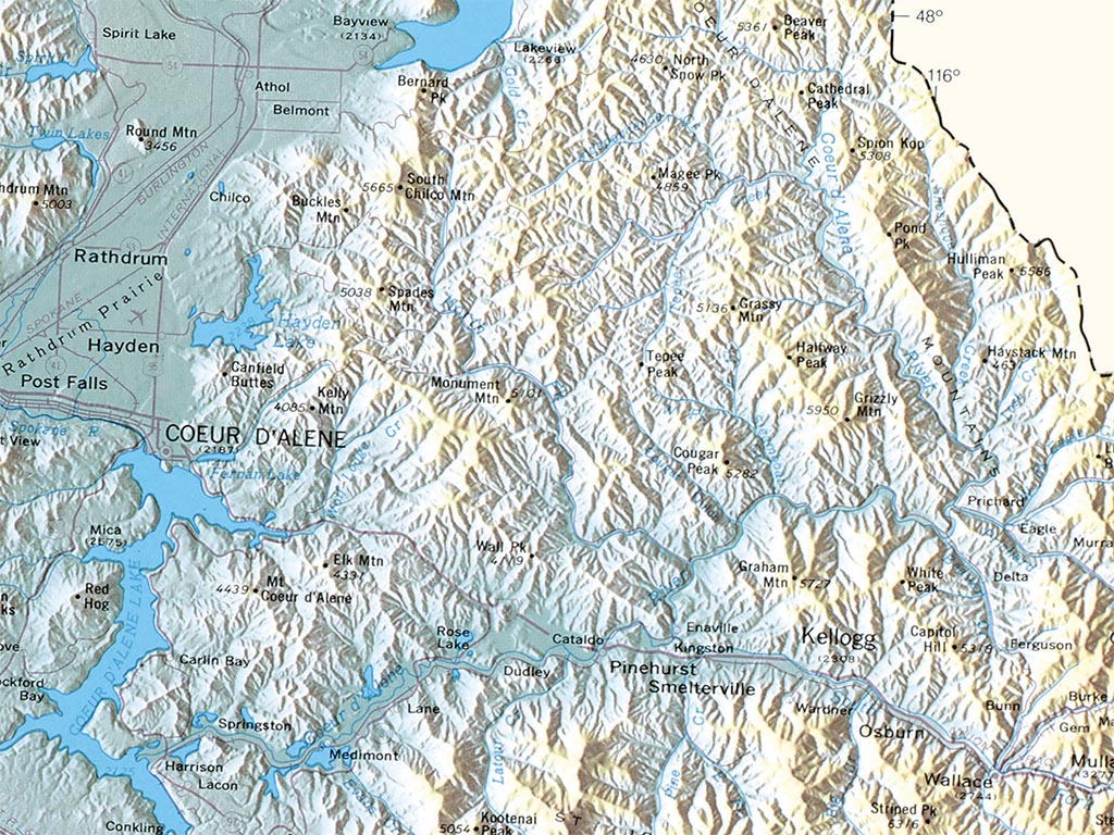
Our new Fine Art Print wall map of Idaho uses elevation tints in subtle hues of green, tan, and brown to show the differences in elevation throughout the state, from Borah Peak, at 12,662', to the confluence of the Snake and Clearwater Rivers at 713'.
This topographic map of Idaho displays an incredible amount of detail, from cities, highways, and mountain ranges, to valleys, rivers, and small towns. The idaho map elevations are represented by color, and this, in combination with our relief shading technique, gives the map a strikingly 3-dimensional look.Dimensions: All map dimensions are approximate.
- Type: Flat Map
- Subtype: Wall Art
- Language: English
- Regions Covered: North America, Northwestern U.S.
- Countries Covered: United States
- States Covered: Idaho
- UPC: 767020012375
- MPN: idaho-elevation-tints-map
- Folded Size: N/A
- Unfolded Size: 28" (W) x 44" (H)
- Finish: Regular Paper