Fishing Hot Spots
Hudson River-South (West Point-Kingston) Fishing Map
Hudson River-South (West Point-Kingston) Fishing Map
Regular price
$14.95 USD
Regular price
Sale price
$14.95 USD
Unit price
per
Shipping calculated at checkout.
Couldn't load pickup availability
- SKU: FHS_HUDSON_S_NY_
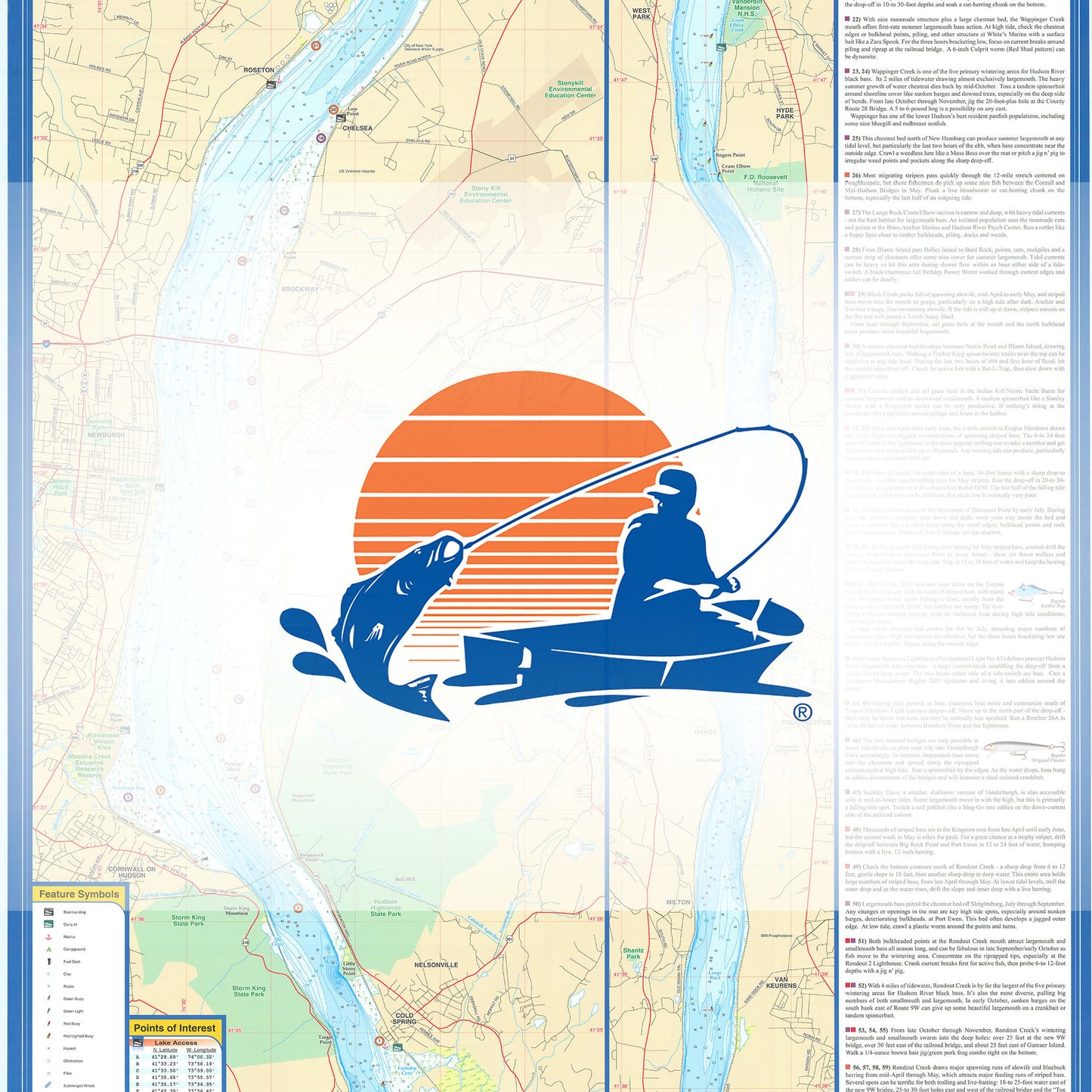
- 1 of a 2 Map Set The lower Hudson River, extending about 155 miles from New York City to Troy, is actually a tidal estuary of the Atlantic Ocean. Largemouth and smallmouth bass are plentiful, with realistic maximums at about six pounds for smallies and seven pounds for largemouth. This map covers fromWest Point to Kingston. Featured Species: Largemouth Bass, Smallmouth Bass, White Perch, White Catfish and Brown Bullhead Map Features: Lake Profile Fishery Information Fishing Tips and Techniques 18Accesses 38Proven Fishing Areas Marked
- Type: Folded Map
- Subtype: Fishing
- Language: English
- Regions Covered: Mid-Atlantic/Northeastern U.S., North America
- Countries Covered: United States
- States Covered: New York
- UPC: 071365004897
- MPN: M489
- Folded Size: 6" (W) x 9" (H)
- Unfolded Size: 24" (W) x 36" (H)
- Weight: 2 oz