USSR Ministry of Defense
Houston, TX 2 (USA) - Soviet Military City Plans
Houston, TX 2 (USA) - Soviet Military City Plans
Regular price
$49.95 USD
Regular price
Sale price
$49.95 USD
Unit price
per
Shipping calculated at checkout.
Couldn't load pickup availability
- SKU: SUAA-HOUSTON2-P
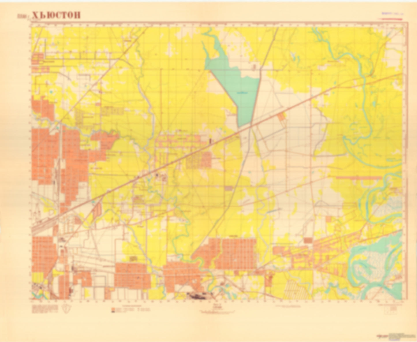
- During the Cold War and before easy access to high-resolution satellite imagery, The Soviet Military was secretly mapping the entire world. These aesthetically striking maps are beautiful down to the last detail and fantastic wall art and until now, have rarely been viewed or available to outsiders. This series has been covered by Wired Magazine and Greg Miller in his book, "All Over the Map: A Cartographic Odyssey". This map is part of the Soviet City Plans Series presented by East View, which has the largest collection of Soviet Military City Plans in the world. The Soviet Military City Plan(s) of Houston, TX 2 (USA) is one in a series of highly detailed topographic city maps developed by the USSR Ministry of Defense during the Cold War era. These collectable, high resolution print-on-demand editions are delivered on premium, acid-free, matte paper. This item is sheet number 2 in a set of 4 sheet(s) for Houston, TX Populated Places: City of Jacinto City Parks and Reservations: Round Prairie Landmarks and Natural Features: Diamond Island, Hog Island Water Bodies: Bakers Lake, Bear Lake, Big Eddy, Bird Lake, Black Lake, Bluebell Lake, Buckhorn Lake, Clear Lake, Faucet Lake, George White Lake, Gordon Lake, Lake Sandy, Little Eddy, Lost Lake, McCracken Lake, Muleshoe Lake, Old River, Rickett Lake, Sheldon Reservoir, Simms Lake, Tank Lake, West Camp Lake
- Type: Map
- Subtype: City Plan
- Language: Russian
- Publication Date: 1965-06-01
- Scale: 1:25,000
- Regions Covered: North America, Southern U.S.
- Countries Covered: United States
- States Covered: Texas
- MPN: HOUSTON 2
- Folded Size: N/A
- Unfolded Size: 40.9" (W) x 34.8" (H)
- Weight: 4.8 oz