Tom Patterson Maps
High Mountain Asia - Physical Features - Paper
High Mountain Asia - Physical Features - Paper
Regular price
$25.00 USD
Regular price
Sale price
$25.00 USD
Unit price
per
Shipping calculated at checkout.
Couldn't load pickup availability
- SKU: PODTP_HMA_PHY
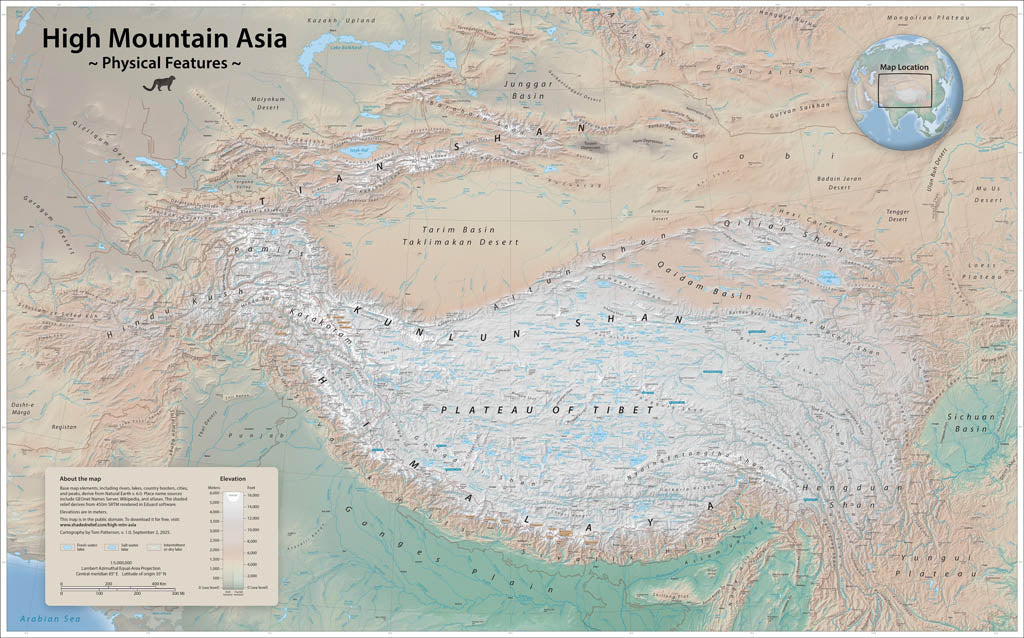
- This is Earth’s loftiest region, formed by the Indian tectonic plate sliding northward beneath the Eurasian plate. It contains the largest reservoir of glacial ice outside of polar regions. Meltwaters from the glaciers feed rivers that nearly 3 billion people in adjacent lowlands depend on for drinking water and crop irrigation. This wall map depicts elevations with cross-blended hypsometric tints and shaded relief. Call-out boxes indicate the fourteen 8,000-meter peaks and the sources of major rivers. Elevations are in meters. Standard Matte Paper (Archival Map Print) Printed on our standard high-quality matte paper, this option offers excellent color accuracy and fine detail with a smooth, non-reflective finish. The matte surface minimizes glare, making it ideal for reading, studying, and framing under glass. FSC-certified and well-suited for both wall display and frequent reference. Best for: Everyday wall maps, educational use, libraries, offices, and framing.
- Subtype: Wall Art
- Language: English
- Scale: 1:5000000
- Folded Size: N/A
- Unfolded Size: 47" (W) x 30" (H)