Raven Maps
Grand Teton National Park Landscape Fine Art Print Map
Grand Teton National Park Landscape Fine Art Print Map
Couldn't load pickup availability
- SKU: PODRP_TETON_LS_16X24_WA
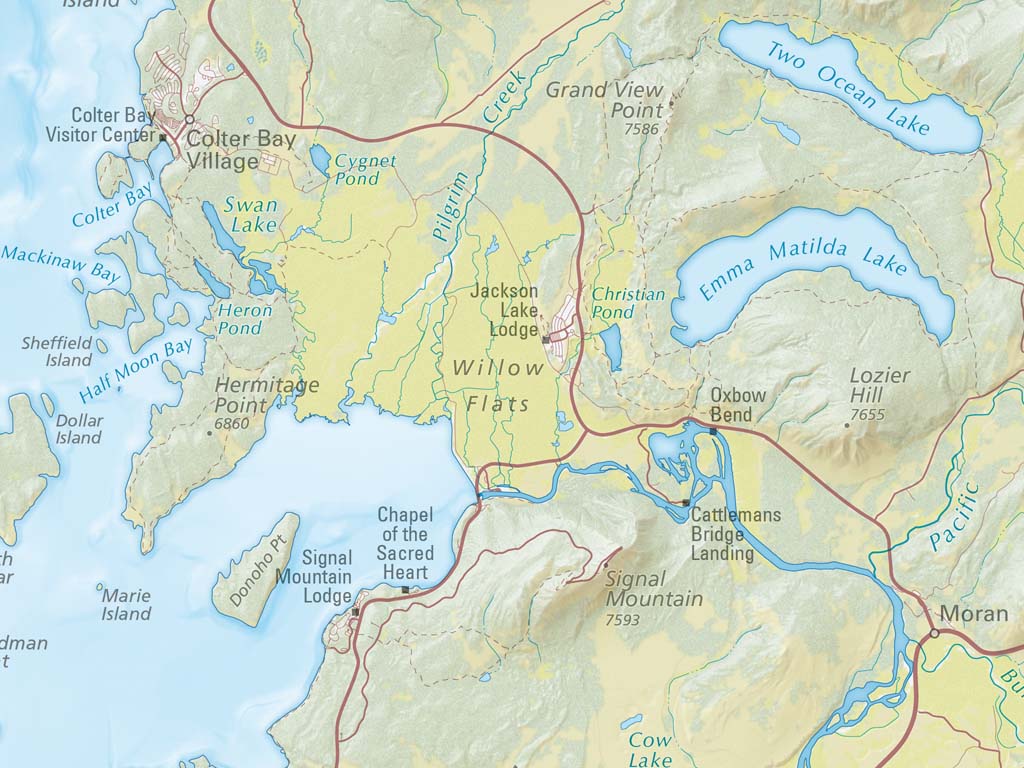
This map showcases the iconic landscapes of Grand Teton National Park in gorgeous detail, from the snowcapped summits of the Teton Range to the banks of the Snake River as it cuts across Jackson Hole. A carefully selected color palette illustrates areas of forest, wetland, grassland, and shrubland, all overlaid on stunning shaded relief that captures the texture and drama of the landscape. Hand-placed labels for mountains, lakes, and rivers fill the park's backcountry while roads, trails, and major points of interest help to orient the viewer and spark memories of previous Grand Teton adventures. Beyond the park's boundaries, a softer shaded relief hints at the surrounding landscape. Roads and gateway communities are illustrated with faded hues, providing geographic context for Grand Teton without distracting from the park itself.
Our Grand Teton National Park landscape map is available in two standard sizes: 24x36"" (1:90,000) and 16x24"" (1:135,500).
- Type: Flat Map
- Subtype: Wall Art
- Language: English
- Scale: 1:135,500
- Regions Covered: North America, Southwestern U.S.
- Countries Covered: United States
- States Covered: Arizona
- UPC: 767020015390
- MPN: PODRP_TETON_LS
- Folded Size: N/A
- Unfolded Size: 16" (W) x 24" (H)
- Finish: Regular Paper