Raven Maps
Grand Canyon National Park Elevation Tints Fine Art Print Map
Grand Canyon National Park Elevation Tints Fine Art Print Map
Couldn't load pickup availability
- SKU: PODRP_GR_CAN_ELEV_24X16_WA
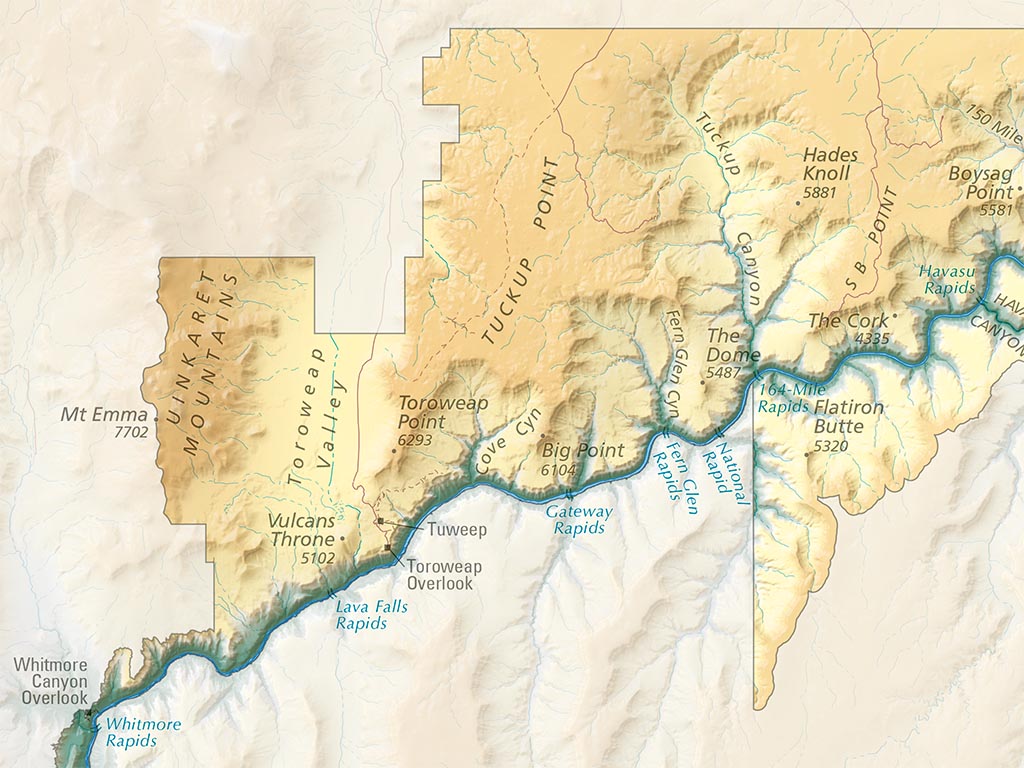
This map illustrates the incomparable landscapes of Grand Canyon National Park, covering all 277 river miles from Lees Ferry to the Grand Wash Cliffs. Our classic hypsometric tints are overlaid on beautiful shaded relief and complimented by hand-placed labels for canyons, buttes, plateaus, and rapids. Roads and trails are shown along with major points of interest within the park, helping to orient the viewer and spark memories of previous adventures in and around the Grand Canyon. Beyond the park's boundaries, a softer shaded relief hints at the surrounding landscape. Roads and gateway communities are illustrated with faded hues, providing geographic context for the canyon without distracting from the park itself.
Our Grand Canyon National Park elevation map is available in two standard sizes: 36"x24" (1:250,000) and 24"x16" (1:375,000).
- Type: Flat Map
- Subtype: Wall Art
- Language: English
- Scale: 1:375,000
- Regions Covered: North America, Southwestern U.S.
- Countries Covered: United States
- States Covered: Arizona
- UPC: 767020012122
- MPN: PODRP_GR_CAN_ELEV
- Folded Size: N/A
- Unfolded Size: 24" (W) x 16" (H)
- Finish: Regular Paper