Mapple
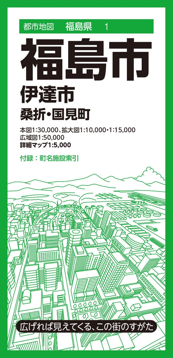
Fukushima City and Vicinity Map
Fukushima City and Vicinity Map
Couldn't load pickup availability
- SKU: MAPP_FUKUSHIMA_25
Explore Fukushima City and its surrounding municipalities with this highly detailed fold-out city map, part of a nationwide series covering approximately 1,000 cities, towns, and villages across Japan. Designed for both everyday navigation and professional use, this comprehensive map provides accurate geographic information and valuable local reference data in an easy-to-read large-format layout.
Product Features
Comprehensive Regional Coverage
This edition includes:
- Main Map (Scale 1:30,000)
- Fukushima City
- Date City
- Koori Town
- Kunimi Town
- Enlarged Area Maps
- Central Date City (1:10,000)
- Iizaka Onsen Area (1:15,000)
- Regional Overview Map (Scale 1:50,000)
- Full coverage of Fukushima City, Date City, Koori Town, Kunimi Town, and surrounding areas
- Bonus Supplement
- Detailed Central Fukushima City Map (1:5,000)
- Reverse side includes a comprehensive town name index and facility index covering government offices, public institutions, and other key locations
Accurate and Easy-to-Read Mapping
The map faithfully represents essential geographic information, including:
- Roads and transportation networks
- Railways and stations
- Addresses and district names
- Public facilities and government buildings
- Commercial establishments
- Natural terrain and geographic features
Convenience stores, fast-food restaurants, gas stations, and other familiar businesses are marked with intuitive logo-based symbols for quick identification.
Convenient Location Search
Color-coded administrative boundaries combined with detailed town and facility indexes make it easy to locate neighborhoods, landmarks, and important destinations.
Ideal For
- Business and sales territory planning
- Area marketing and market research
- Real estate professionals
- Distribution and demographic mapping
- Community safety and disaster preparedness planning
- Local reference and travel planning
- Unique gifts for school admissions, relocations, or local enthusiasts
Dimensions
Map Size (Unfolded)
109.1 × 78.8 cm
Package Size
10.3 × 21.3 × 0.85 cm
About the Series
This large-format fold-out map series offers a clear visual overview of each municipality on a single sheet, combining practical geographic information with insights into the area's unique characteristics. Whether for personal, professional, or educational use, it serves as a valuable guide to understanding and navigating local communities.
- Main Map (Scale 1:30,000)
- Type: Folded Map
- Subtype: City Maps
- Language: Japanese
- Publication Date: 2025-05-16
- Scale: 1:5,000 / 1:10,000 / 1:15,000 / 1:30,000 / 1:50,000
- Regions Covered: Asia, East Asia, Pacific Ocean
- Countries Covered: Japan
- States Covered: Fukushima
- ISBN: 9784398907318
- Folded Size: 4" (W) x 8" (H)
- Unfolded Size: 43" (W) x 31" (H)