Latitude 40° Maps
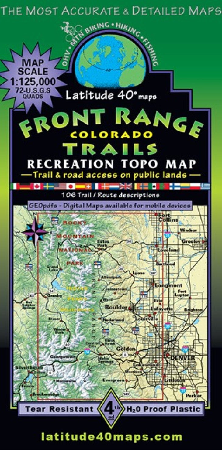
Front Range Trails Hiking Map
Front Range Trails Hiking Map
Regular price
$14.95 USD
Regular price
Sale price
$14.95 USD
Unit price
per
Shipping calculated at checkout.
Low stock
Couldn't load pickup availability
- SKU: LAT40_FRONT_23
- Front Range Trails shows you where to go in Colorado's Northern Front Range to find access points for many hundreds of miles of trails and roads. The "where to go and how to get there map" is an incredible resource for planning a lifetime of trail adventures in the region. Regional map shows all public lands in the Northern Front Range front country and backcountry. Twosided, covering 76 miles north to south from Ft. Collins, south to Chatfield Reservoir. East to west for 50 miles from the west side of Denver, west to the mountain town of Silverthorne on the Rockies western slope. Public access trail and road information is shown for all user groups with mileage between junctions and route difficulty ratings - hiking, equestrian, mt. bikes and OHV routes are highlighted for public access. The frontside features 106 short trail/ route descriptions with elevation/distance profiles and difficulty ratings. Small elevation-tinted relief images help visualize the spatial relationships of physical features in the region. Featuring Recreation areas, Preserves, Natural Areas, City of Boulder Open Space (OS) and Mountain Parks, Denver Mountain Parks, Parks and Open Space for suburbs and communities west of Denver, Boulder, Clear Creek, Gilpin, Grand, Larimer and Jefferson County Open Space, Rocky Mountain National Park, Arapaho National Recreation Area. State Parks and Wildlife Areas. Features Indian Peaks, Mt. Evans aka Blue Sky, James Pk., Never Summer and Vasquez Wildernesses and portions of Byers Pk., Comanche Pk., Neota and Ptarmigan Pk. Wilderness Areas. Trailheads, campgrounds, dispersed camping, picnic areas, day use areas, parking/ pullouts, mtn. huts, cabins and yurts. Locations of mines, adits or caves, remnants of old mills and mining camps, ghost towns and historical townsites. As well as points of interest, special geologic areas and scenic viewpoints/overlooks. Hundreds of miles of paved recreation pathways and natural surface trails throughout the urban/suburban communities in the plains.
- Type: Folded Map
- Subtype: Hiking
- Language: English
- Publication Date: 2023-06-01
- Scale: 1:125,000
- Regions Covered: Central U.S., North America
- Countries Covered: United States
- States Covered: Colorado
- ISBN: 9781879866522
- Folded Size: 4" (W) x 8" (H)
- Unfolded Size: 25" (W) x 39" (H)
- Weight: 3 oz