Frankos Maps Ltd.
Franko's guide map of the U.S. Virgin Islands : St Croix : on this side of map : St. Thomas & St. John : on reverse
Franko's guide map of the U.S. Virgin Islands : St Croix : on this side of map : St. Thomas & St. John : on reverse
Regular price
$17.99 USD
Regular price
Sale price
$17.99 USD
Unit price
per
Shipping calculated at checkout.
Low stock
Couldn't load pickup availability
- SKU: FM_USVI_LAM_21
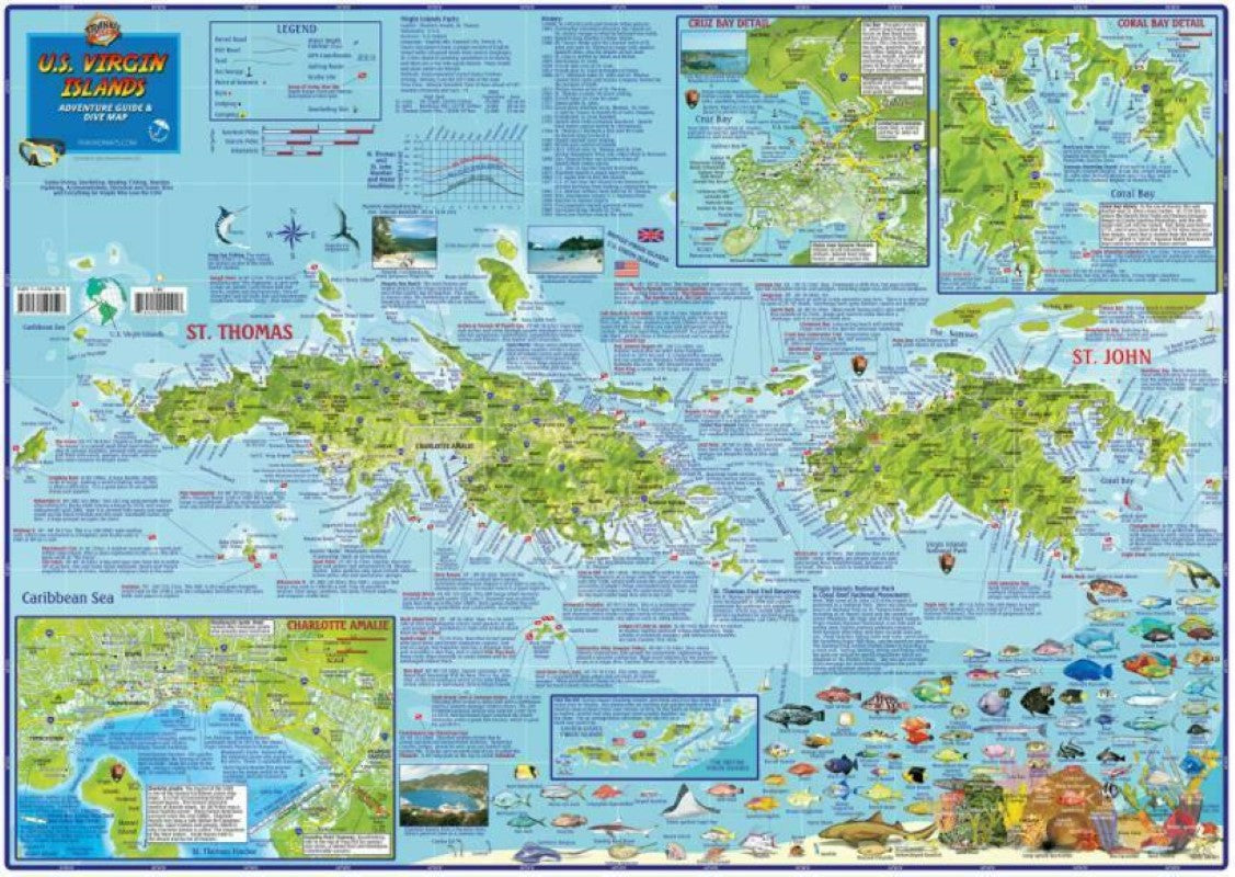
Side One covers St. Thomas and St. John, with inset maps of Charlotte Amalie, Cruz Bay, and Coral Bay. There are colorful illustrations of USVI coral reef creatures.
Side Two is a map of St. Croix, with insets of Frederiksted and Christiansted, along with more fish illustrations.
Dive and snorkel sites are located, named, and described with detailed text. The map is loaded with information for everything there is to see and do.18.5” x 26”, laminated with edge seal, shipped rolled.
- Type: Flat Map
- Subtype: Travel
- Language: English
- Publication Date: 2008-06-01
- Scale: Scales differ
- Regions Covered: Caribbean Sea, North America
- Countries Covered: Puerto Rico, Virgin Islands, United States
- ISBN: 9781601904980
- Folded Size: N/A
- Unfolded Size: 18.9" (W) x 26.77" (H)
- Weight: 3 oz