Fish-n-Map Company
Franklin D. Roosevelt Lake Fishing Map
Franklin D. Roosevelt Lake Fishing Map
Couldn't load pickup availability
- SKU: FNM_FDR_LK_22
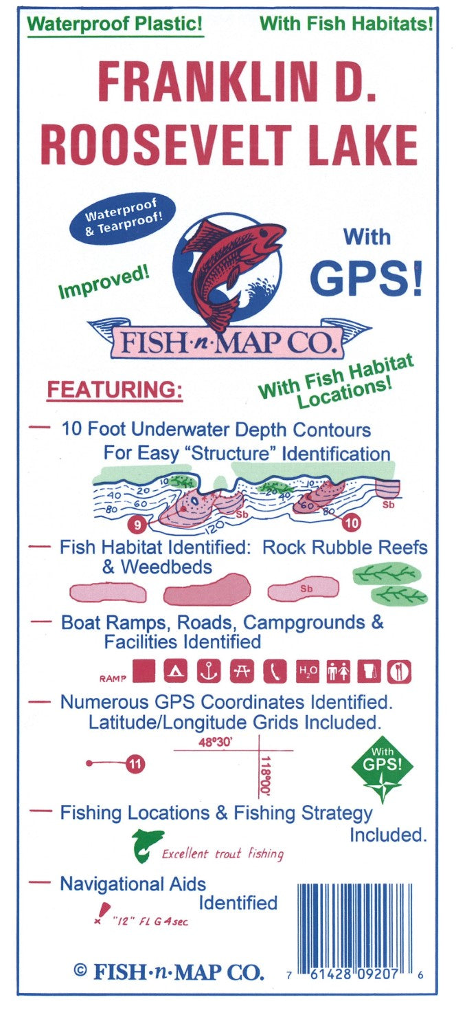
Fish-N-Map Company underwater topography maps are printed on a waterproof, tear-resistant material and are folded to 9" x 4". When opened, each map is approximately 3' x 2' in size and is printed on both sides. These maps feature waterproof plastic "paper"; underwater depth contours; fish locations; latitude and longitude for GPS; often multiple lakes on one map; boat ramps; recreational facilities; and much more.
Map Features:
10 foot underwater depth contours
Numerous suggested fishing locations shown throughout map
Fishing Strategy
Latitude and longitude grids with over 80 GPS coordinates identified
GPS Quick Scaler
Underwater structures identified including underwater river channels, railroad tracks, shoals, point bars, humps
Underwater bottom conditions identified: Sand, rocky, mud
Boat ramps, roads, facilities shown
Waterproof and Tear-resistant plastic, folds to 9”x4”, unfolds to 3’x2’, 2-sided map• Added Fish Habitat (Rock Rubble Reefs, fair & good)
• Onshore Facilities and Roads Updated
• Additional Feeder Cuts Added
• Map is scaled using NAD 83 for the datum
• A third color has been added to the map (green)
Made in the U.S.A.- Type: Folded Map
- Subtype: Fishing
- Language: English
- Publication Date: 2022-06-01
- Scale: Scale not provided
- Regions Covered: North America, Northwestern U.S.
- Countries Covered: United States
- States Covered: Washington
- UPC: 761428092076
- Folded Size: 4" (W) x 9" (H)
- Unfolded Size: 36" (W) x 24" (H)
- Weight: 1.7 oz