USSR Ministry of Defense
Erie, PA (USA) - Soviet Military City Plans
Erie, PA (USA) - Soviet Military City Plans
Regular price
$49.95 USD
Regular price
Sale price
$49.95 USD
Unit price
per
Shipping calculated at checkout.
Couldn't load pickup availability
- SKU: SUAA-ERIE-P
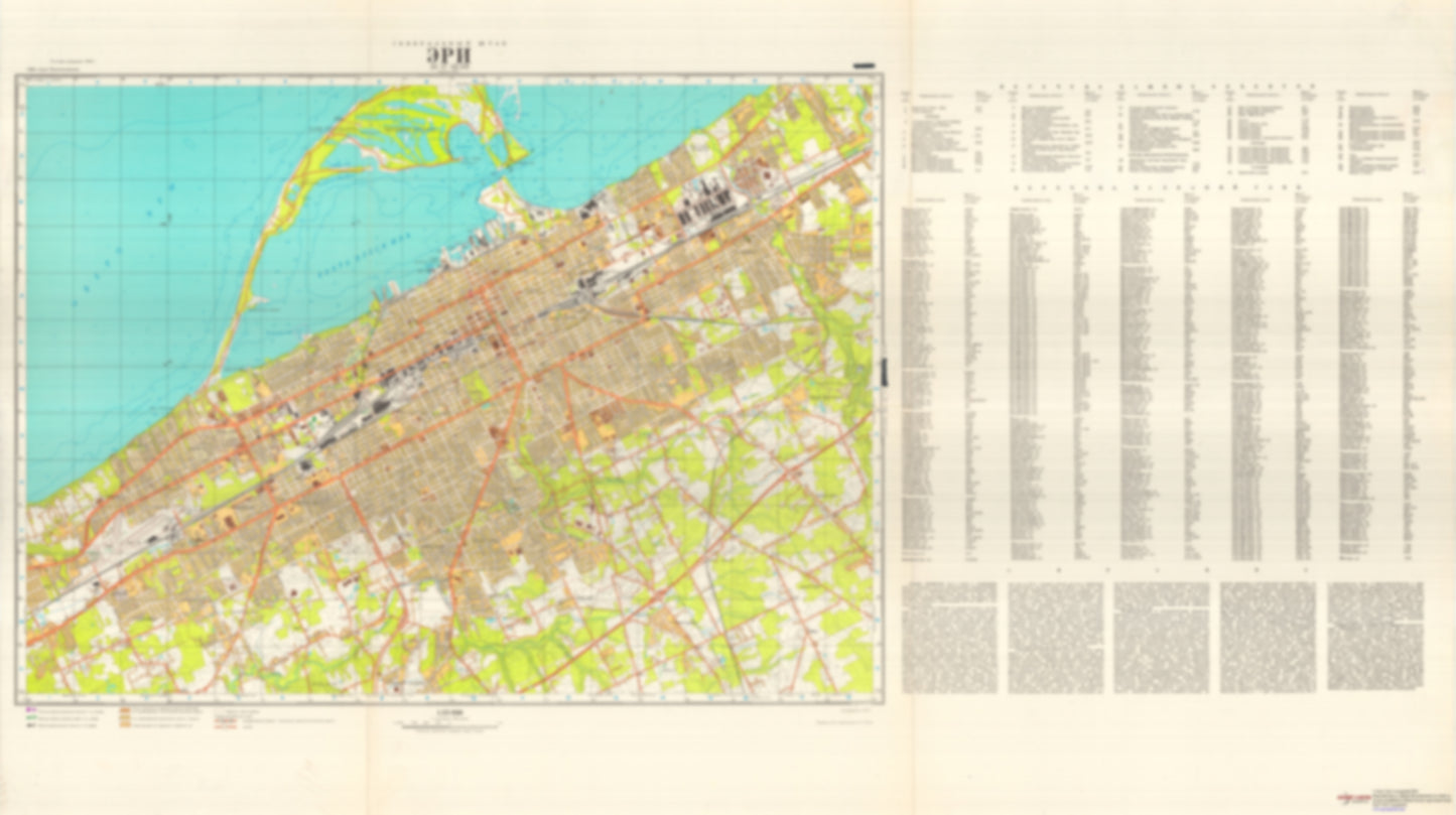
- During the Cold War and before easy access to high-resolution satellite imagery, The Soviet Military was secretly mapping the entire world. These aesthetically striking maps are beautiful down to the last detail and fantastic wall art and until now, have rarely been viewed or available to outsiders. This series has been covered by Wired Magazine and Greg Miller in his book, "All Over the Map: A Cartographic Odyssey". This map is part of the Soviet City Plans Series presented by East View, which has the largest collection of Soviet Military City Plans in the world. The Soviet Military City Plan(s) of Erie, PA (USA) is one in a series of highly detailed topographic city maps developed by the USSR Ministry of Defense during the Cold War era. These collectable, high resolution print-on-demand editions are delivered on premium, acid-free, matte paper. This item is sheet number 1 in a set of 1 sheet(s) for Erie, PA Populated Places: City of Erie, Erie County, Township of Lawrence Park, Township of Millcreek Landmarks and Natural Features: Crystal Point, Presque Isle Water Bodies: Approach Turning Basin, Erie Harbor Entrance Channel, Erie Turning Basin, Harbor Basin, Harbor Turning Basin, Misery Bay, Presque Isle Bay, Thompson Bay
- Type: Map
- Subtype: City Plan
- Language: Russian
- Publication Date: 1976-06-01
- Scale: 1:25,000
- Regions Covered: Mid-Atlantic/Northeastern U.S., North America
- Countries Covered: United States
- States Covered: Pennsylvania
- MPN: ERIE
- Folded Size: N/A
- Unfolded Size: 49.2" (W) x 27.6" (H)
- Weight: 4.8 oz