Fish-n-Map Company
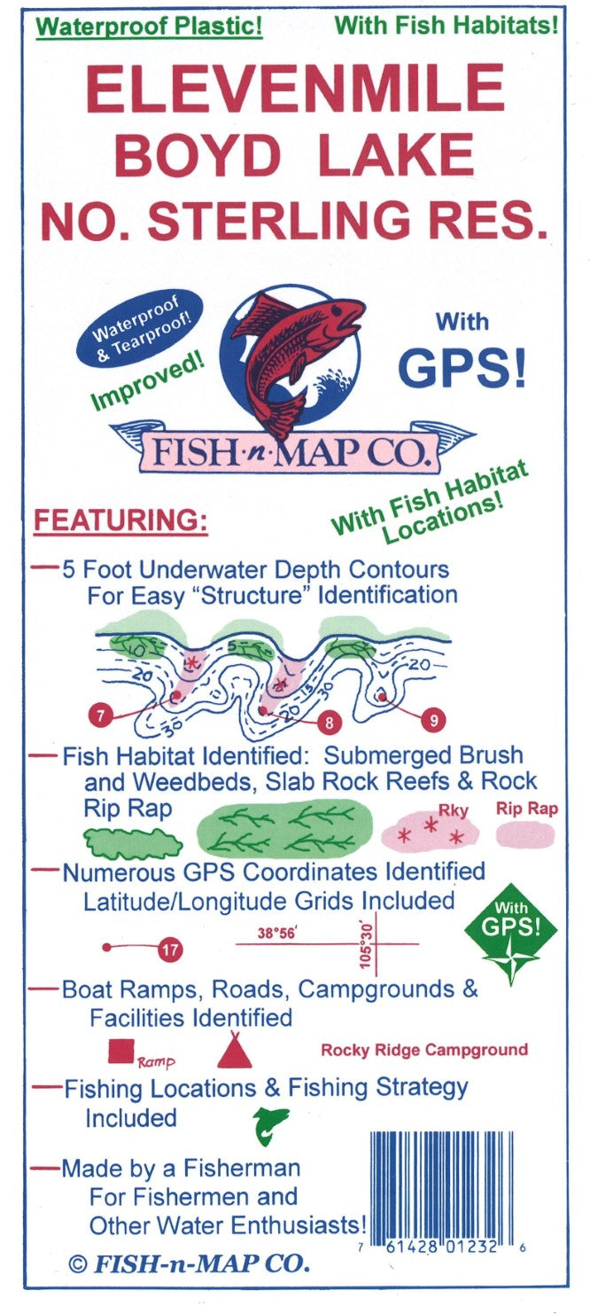
Elevenmile/Boyd Lake/N. Sterling Reservoir Fishing Map
Elevenmile/Boyd Lake/N. Sterling Reservoir Fishing Map
Couldn't load pickup availability
- SKU: FNM_ELEV_22
This Fish-N-Map Company underwater topography map is printed on waterproof, tear-resistant material and features 5' underwater depth contours, fish locations, latitude and longitude for GPS, boat ramps, recreational facilities, and much more.
• Added additional fish habitat to Eleven Mile including submerged weedbeds, rock rubble reefs and onshore brush and trees
• Added Boyd Lake and North Sterling Reservoir to backside of map
• Added fish habitat to Boyd Lake and North Sterling Reservoir which includes weedbeds and submerged brush
• Added fishing strategies to Boyd Lake and North Sterling Reservoir
• New 1-minute longitude and latitude grids for Boyd Lake and North Sterling Reservoir which use a datum of NAD 83
• New GPS coordinates provided for Boyd Lake and North Sterling Reservoir
• Now a 3-color map for all three reservoirs
2017 Updates for Eleven Mile Reservoir:
Updated Latitude/Longitude Grids and GPS values using NAD 83 for DatumMAP FEATURES:
3 Lakes on 1 Map
5-foot depth contours provided for easy structure identification
Fishing Suggestions provided for Eleven Mile Reservoir
Fishing Strategies included for Eleven Mile Reservoir, Boyd Lake and North Sterling Reservoir
Fish Habitat locations provided
Latitude/Longitude grids plus numerous GPS values identified
Boat ramps, roads, campgrounds and facilities identified
Printed onto a waterproof, tear-resistant material. This 2-sided map folds to 9" x 4" and unfolds to 3' x 2'
MADE IN THE U.S.A.- Type: Folded Map
- Subtype: Fishing
- Language: English
- Publication Date: 2022-06-01
- Scale: 1:63,360,000
- Regions Covered: North America, Western U.S.
- Countries Covered: Mexico, United States
- States Covered: Colorado
- UPC: 761428012326
- Folded Size: 3.94" (W) x 9.06" (H)
- Unfolded Size: 17.32" (W) x 31.5" (H)
- Weight: 3 oz