USSR Ministry of Defense
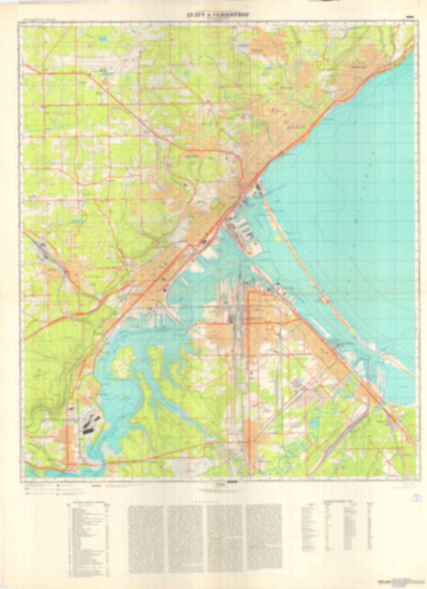
Duluth, MN, Superior, WI (USA) - Soviet Military City Plans
Duluth, MN, Superior, WI (USA) - Soviet Military City Plans
Regular price
$49.95 USD
Regular price
Sale price
$49.95 USD
Unit price
per
Shipping calculated at checkout.
Couldn't load pickup availability
- SKU: SUAA-DULUTH-SUPERIOR-P
- During the Cold War and before easy access to high-resolution satellite imagery, The Soviet Military was secretly mapping the entire world. These aesthetically striking maps are beautiful down to the last detail and fantastic wall art and until now, have rarely been viewed or available to outsiders. This series has been covered by Wired Magazine and Greg Miller in his book, "All Over the Map: A Cartographic Odyssey". This map is part of the Soviet City Plans Series presented by East View, which has the largest collection of Soviet Military City Plans in the world. The Soviet Military City Plan(s) of Duluth, MN, Superior, WI (USA) is one in a series of highly detailed topographic city maps developed by the USSR Ministry of Defense during the Cold War era. These collectable, high resolution print-on-demand editions are delivered on premium, acid-free, matte paper. This item is sheet number 1 in a set of 1 sheet(s) for Duluth, MN, Superior, WI Populated Places: City of Duluth, City of Hermantown, City of Proctor, City of Superior, Township of Herman (historical) Landmarks and Natural Features: Bardon Peak, Barkers Island, Chases Point, Clough Island, Connors Point, Dwights Point, Elys Peak, Grassy Point, Hearding Island, Hog Island, Kilchlis Meadow, Minnesota Point, Park Point, Rices Point, Spirit Island, Tallas Island, Wisconsin Point Water Bodies: Allouez Bay, Allowez Bay Channel, East Gate Basin, Goose Lake, Howards Bay, Kimballs Bay, Little Pokegama Bay, Minnesota Channel, Mogie Lake, Mud Lake, North Channel, Pokegama Bay, Saint Louis Bay, Saint Louis Bay, South Channel, Spirit Lake, Superior Bay, Superior Bay, Superior Entry, Superior Entry Channel, Superior Front Channel, Superior Harbor Basin, Twin Lakes, West Gate Basin
- Type: Map
- Subtype: City Plan
- Language: Russian
- Publication Date: 1975-06-01
- Scale: 1:25,000
- Regions Covered: Midwest, North America
- Countries Covered: United States
- States Covered: Minnesota
- MPN: DULUTH, SUPERIOR
- Folded Size: N/A
- Unfolded Size: 34.6" (W) x 47.6" (H)
- Weight: 4.8 oz