Tabacco Map
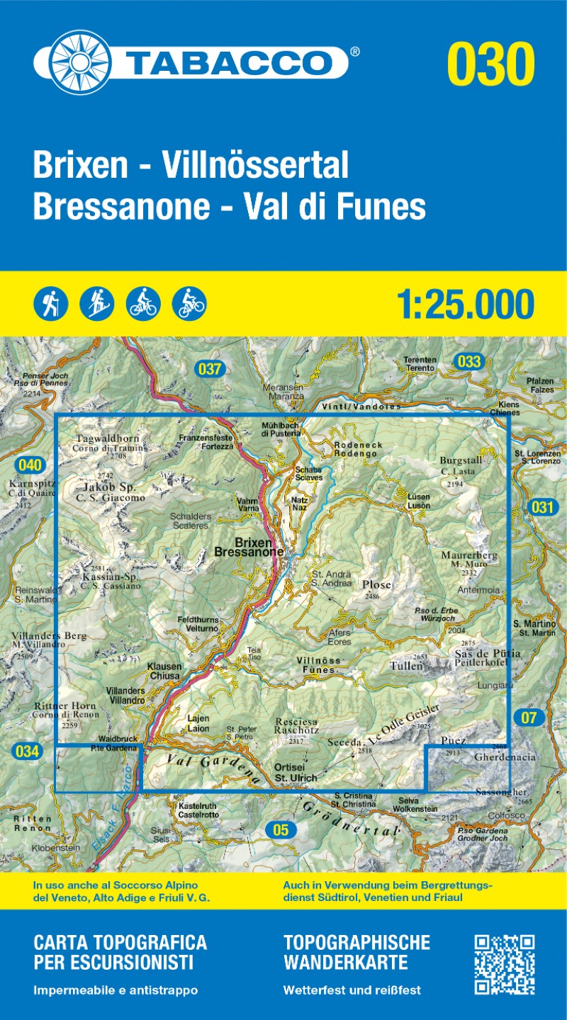
Dolomiti di Braies - Marebbe/Pragser Dolomiten - Enneberg, Italy Topographic Hiking Map #31
Dolomiti di Braies - Marebbe/Pragser Dolomiten - Enneberg, Italy Topographic Hiking Map #31
Couldn't load pickup availability
- SKU: TAB_31_BRAIES_25
Discover the stunning alpine landscapes of Bressanone (Brixen) and Val di Funes (Villnößtal) with this premium Tabacco topographic hiking map, part of the acclaimed 1:25,000 series covering the Dolomites and northeastern Italy. Renowned for its precise cartography and rich overprint, this map is ideal for hikers, cyclists, and ski mountaineers.
Key Features:
New 2025 Edition printed on tear-resistant, waterproof, and photodegradable material — built to last and eco-conscious.
Extensive Overprint for hiking trails, ski mountaineering routes, cycle tracks, mountain bike trails, local bus stops, and other recreational features.
Double-sided printing for expanded area coverage without extra bulk.
UTM WGS84 kilometer grid system and latitude/longitude ticks for accurate GPS navigation.
Used by Mountain Rescue Services in Veneto, South Tyrol, and Friuli Venezia Giulia, ensuring professional-level reliability.
Multilingual (Italian and German) to suit international users.
This map is part of Stanfords' most popular series for the region, trusted by outdoor enthusiasts for its clarity, detail, and durability. Whether you're planning a scenic hike, ski tour, or bike route, this map is your essential companion in the heart of the Dolomites.
- Subtype: Hiking
- Language: English, French, German, Italian
- Publication Date: 2025-06-01
- Scale: 1:25,000
- Regions Covered: Alps, Europe, Western Europe
- Countries Covered: Italy
- ISBN: 9788883151736
- MPN: 031-2
- Folded Size: 5.11" (W) x 9.21" (H)
- Unfolded Size: 31.5" (W) x 34.25" (H)
- Weight: 3.52 oz